|
OK Mesonet
The Oklahoma Mesonet is a world-class network of environmental
monitoring stations. The network was designed and implemented by
scientists at the University of Oklahoma (OU) and at Oklahoma State
University (OSU).
The Oklahoma Mesonet consists of 114 automated stations covering
Oklahoma. There is at least one Mesonet station in each of
Oklahoma's 77 counties.
At each site, the environment is measured by a set of instruments
located on or near a 10-meter-tall tower. The measurements are
packaged into "observations" every 5 minutes, then the observations
are transmitted to a central facility every 15 minutes, 24 hours per day
year-round.
The Oklahoma Climatological Survey (OCS) at OU receives the
observations, verifies the quality of the data and provides the data to
Mesonet customers. It only takes 10 to 20 minutes from the time the
measurements are acquired until they become available to customers,
including schools.
As the customers and LDAS investigators, we obtained the data from Oklahoma Mesonet and use them to do LDAS validation.
We also do data quality control and data analysis, but we are not allowed to distribute this valuable dataset. Please contact Oklahoma Mesonet
for data.
More information about Oklahoma Mesonet can be found here. |
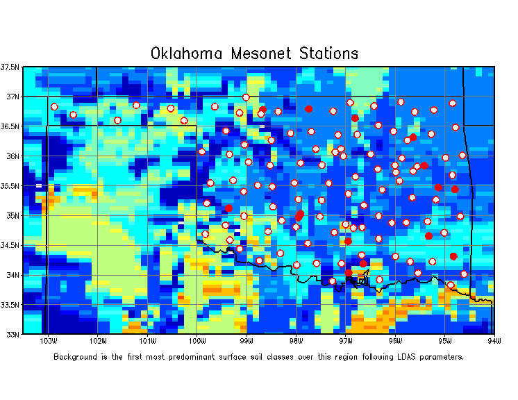
Click on the stations to view the time series.
| Soil Moisture and Soil Temperature Animations |
|
|
|
|