Nearshore Wave Prediction System
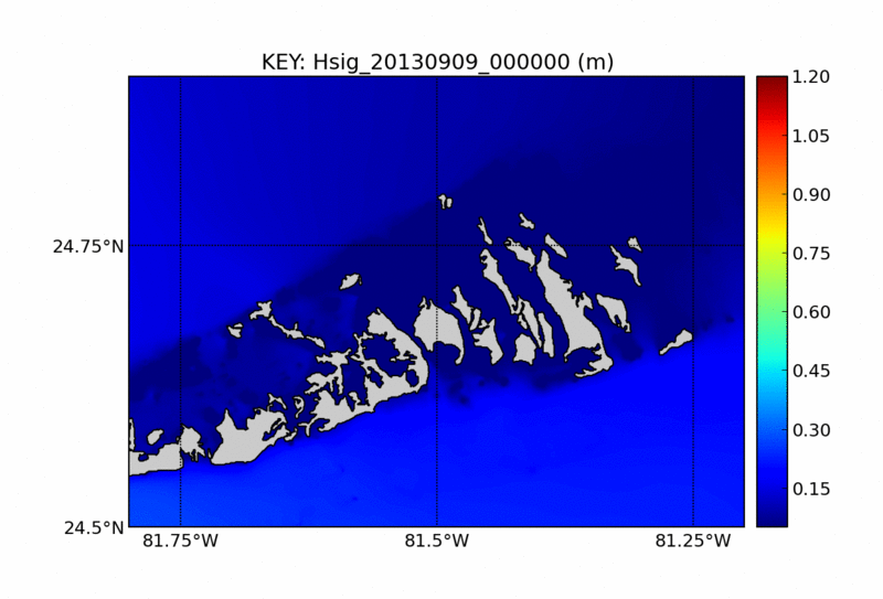
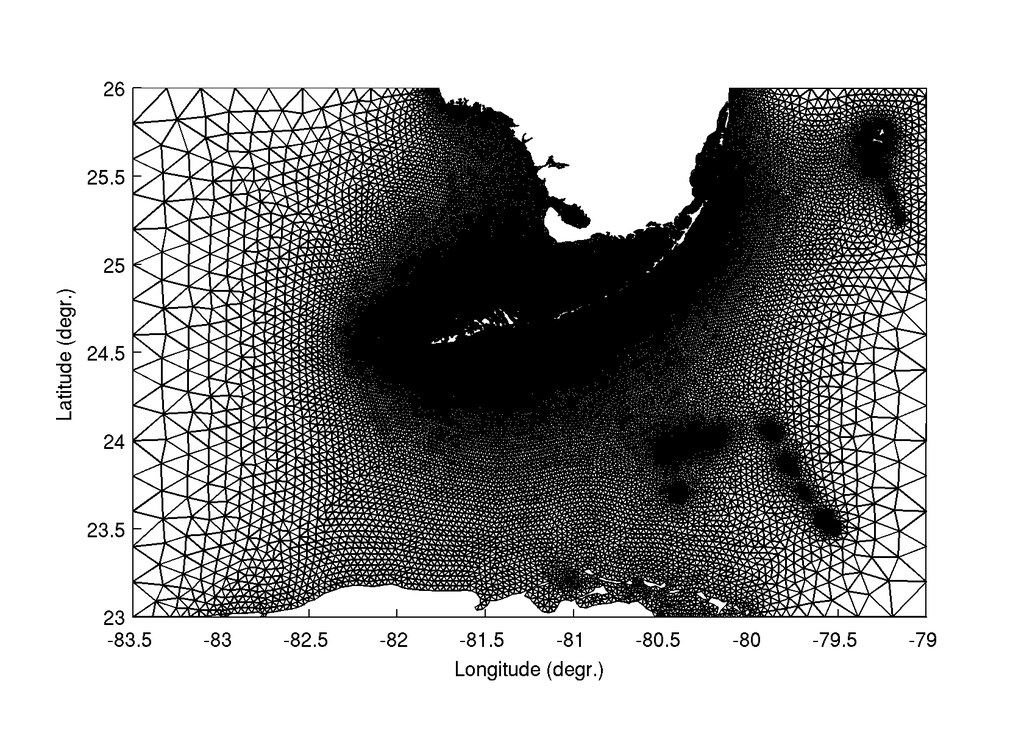
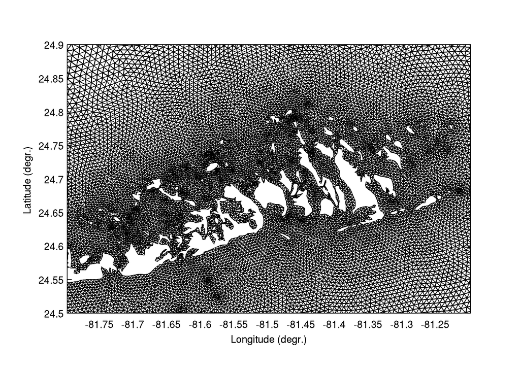
Above : sample NWPS forecast guidance with the SWAN wave model over a portion of the Florida Keys

|
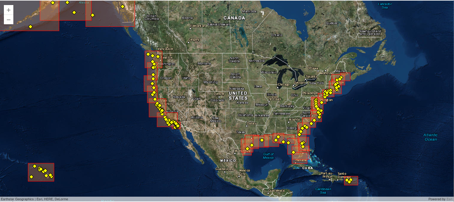
The Nearshore Wave Prediction System (NWPS) was implemented into NCEP's Production Suite in 2016. It provides on-demand, high-resolution nearshore wave model guidance to U.S. coastal WFOs, triggered in real time by forecast wind grids prepared and submitted by the individual offices. NWPS is maintained and developed by NCEP's Environmental Modeling Center (EMC) in collaboration with a number of Weather Forecast Offices (WFOs), as well as partners at NOAA/NOS, USGS and USACE. NWPS is driven by forecaster-developed wind grids produced in AWIPS, and wave boundary conditions from the operational WAVEWATCH III model. The nearshore wave model used is the Simulating Waves Nearshore (SWAN) Model. Wave-current interaction is included using surface currents from the Real-Time Ocean Forecast System (RTOFS-Global). Tides and storm surge are accounted for using the Extratropical Surge and Tide Operational Forecast System (ESTOFS, extratropical conditions), or the probabilistic model P-SURGE (tropical conditions). The computational grids have a nearshore resolution of 1.8 km-500 m. NWPS produces fields of integral wave parameters, wave spectra, and individually tracked wave systems (Gerling-Hanson plots). Experimental rip current and total water level guidance is produced at 5 pilot WFOs. Access the NWPS Model Status Page Coastal Hazards: Total Water Level ViewerThis tool displays experimental total water level and coastal change model guidance for select regions of the U.S. coastline using NWPS output and local beach characteristics (Courtesy of U.S. Geological Survey)
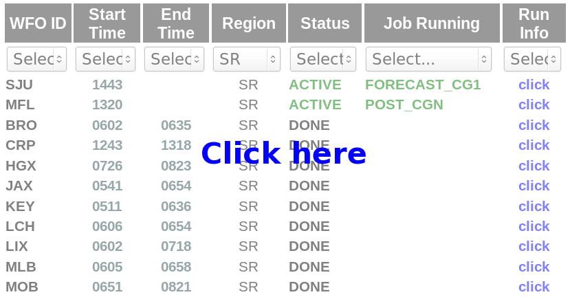
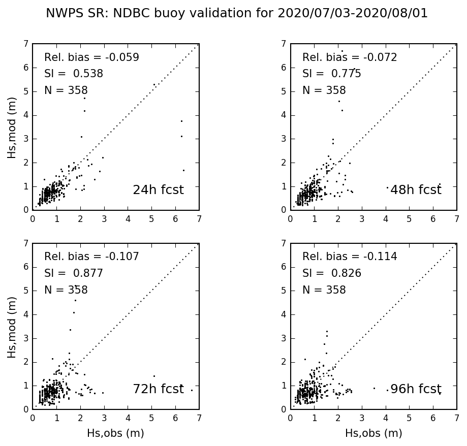
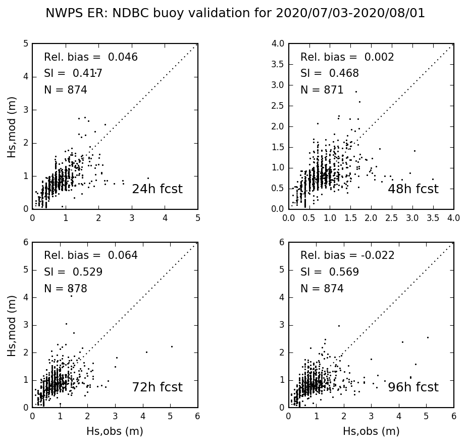
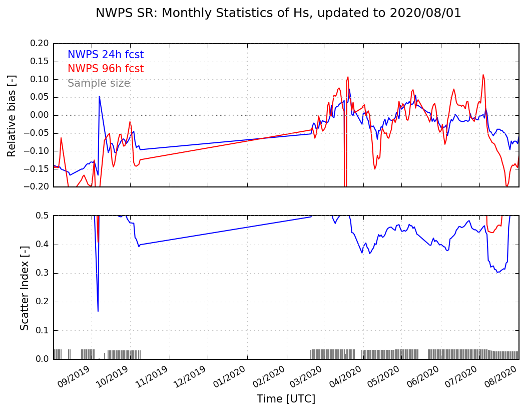
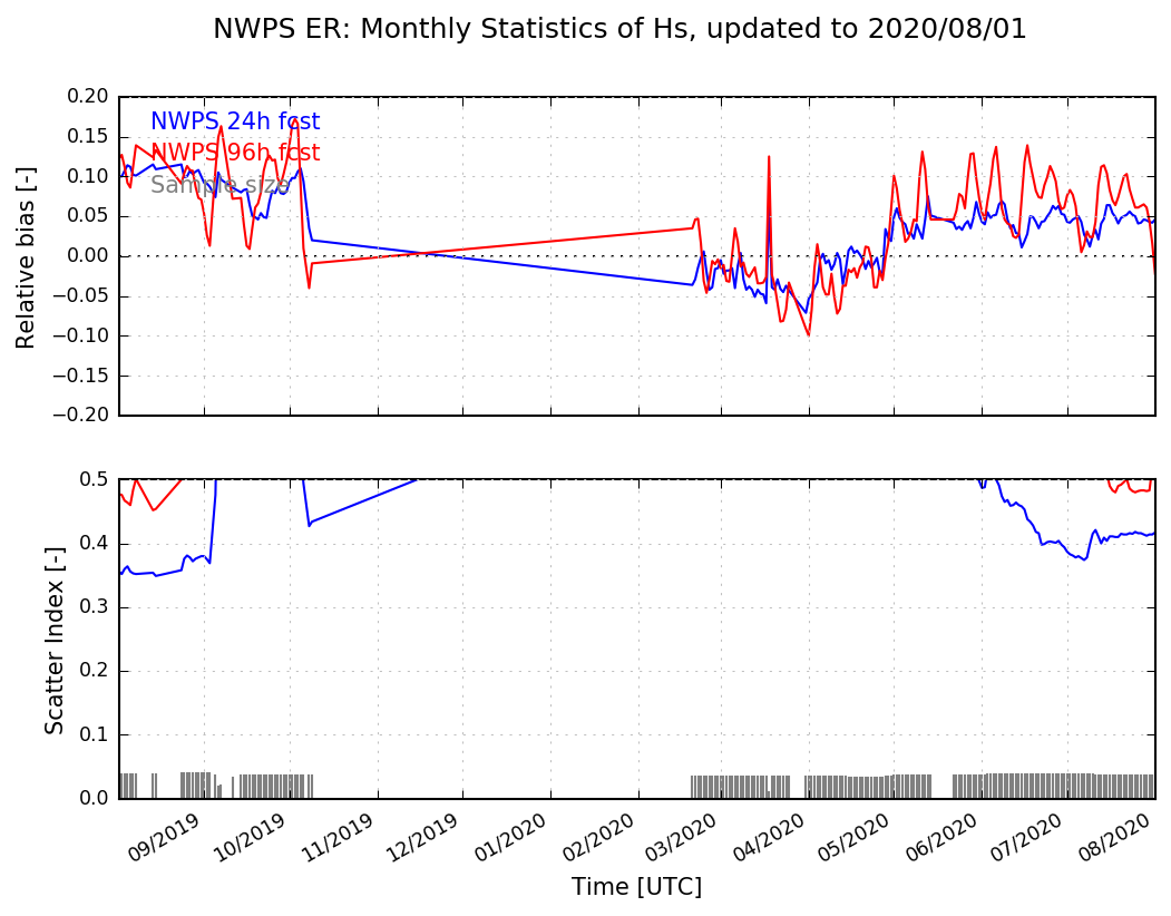
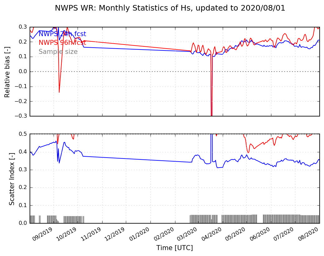
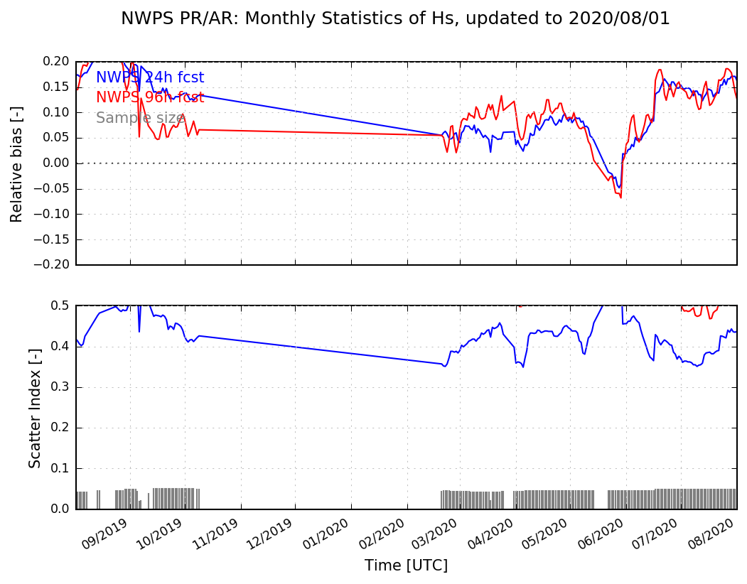
Monthly Validation - Southern and Eastern RegionsBelow are sample combined monthly validation statistics at all coastal data buoys in the NWS Southern and Eastern Regions respectively, computed as a 30-day, moving-window retrospective (Open in a new tab to enlarge). For real-time validation, as well as buoy-specific validation statistics, enter the NWPS model viewer above and click on an individual station.
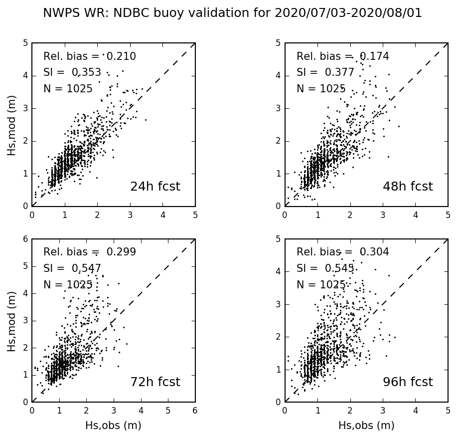
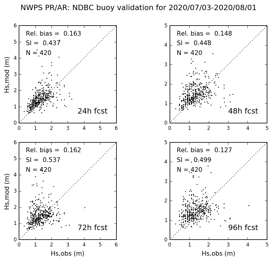
Monthly Validation - Western, Pacific and Alaska RegionsBelow are sample combined monthly validation statistics at all coastal data buoys in the NWS Western, Pacific and Alaska Regions, computed as a 30-day, moving-window retrospective (Open in a new tab to enlarge). For real-time validation, enter the NWPS model viewer above and click on an individual station.
For More InformationSign up for the NWPS mailing list for updates and information on this system. Follow the system development on our Wiki Page (authorization required). If you want to go to the original NWPS page on polar.ncep.noaa.gov, click here.
ReferencesGibbs A., G. Dusek, A. J. van der Westhuysen, P. Santos, S. Stripling, S. Huddleston, E. Rivera-Acevedo, J. Estupinan, and H. Seim. Numerical Validation of a Coupled Probabilistic Rip Current Model and Nearshore Wave Prediction System for South Florida. Proc. 95th AMS Annual Meeting, Am. Meteor. Soc., Phoenix, 2015. Available here Dusek G., A. J. Van der Westhuysen, A. Gibbs, D. King, S. Kennedy, R. Padilla, H. Seim, and D. Elder. Coupling a Rip Current Forecast Model to the Nearshore Wave Prediction System. Proc. 94th AMS Annual Meeting, Am. Meteor. Soc., Atlanta, 2014. Available here Van der Westhuysen, A. J., A. A. Taylor, R. Padilla-Hernandez, A. Gibbs, P. Santos, D. Gaer, H. D. Cobb III, J. R. Lewitsky, and J. R. Rhome. Enhancements to the Nearshore Wave Prediction System to provide Coastal and Overland Hurricane Wave Guidance. Proc. 94th AMS Annual Meeting, Am. Meteor. Soc., Atlanta, 2014. Available here Van der Westhuysen, A. J., R. Padilla-Hernandez, P. Santos, A. Gibbs, D. Gaer, T. Nicolini, S. Tjaden, E. M. Devaliere and H. L. Tolman. Development and validation of the Nearshore Wave Prediction System. Proc. 93rd AMS Annual Meeting, Am. Meteor. Soc., Austin, 2013. Available here Gibbs, A., P. Santos, A. J. van der Westhuysen and R. Padilla-Hernandez. NWS Southern Region Numerical Optimization and Sensitivity Evaluation in Non-Stationary SWAN Simulations. Proc. 92nd AMS Annual Meeting, Am. Meteor. Soc., New Orleans, 2012. Available here Settelmaier, J. B., A. Gibbs, P. Santos, T. Freeman, D. Gaer. Simulating Waves Nearshore (SWAN) Modeling Efforts at the National Weather Service (NWS) Southern Region (SR) Coastal Weather Forecast Offices (WFOs). Proc. 91st AMS Annual Meeting, Am. Meteor. Soc., Seattle, 2011. Available here Updates to NWPS : 2018 and 2021Two upgrades to NWPS have been implemented since 2016. In 2018, additional NWPS data was added to the SBN and NOAAPort. Forecast length was increased to 144 hours (from 102 hours) with an increased frequency to 1 hour (from 3 hours). This upgrade also features the transition from regular model grids to unstructured computational meshes for 10 WFOs (TBW, MFL, SJU, MHX, AKQ, OKX, BOX, CAR, SGX, HFO) for improved nearshore accuracy. See the NWS Service Change Notice on the 2018 upgrade for more details. In 2021, the NWPS was upgraded with these changes (link to NWS Service Change Notice is here):
|