
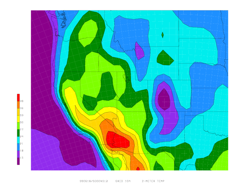
This page shows the differences in looking at a
field with much local detail on different Eta model
output grids. The field is 2-meter temperature. The
first plot is the grid #104 which has a resolution of 80 km.
 The next plot is for the same forecast (same field and time),
but it is on the higher resolution grid #212 (40 km resolution).
Note the far superior detail, especially over the higher terrain
locations. The cooler temperatures over the Sierra Nevada mountain
range of eastern California show up quite dramatically.
The next plot is for the same forecast (same field and time),
but it is on the higher resolution grid #212 (40 km resolution).
Note the far superior detail, especially over the higher terrain
locations. The cooler temperatures over the Sierra Nevada mountain
range of eastern California show up quite dramatically.
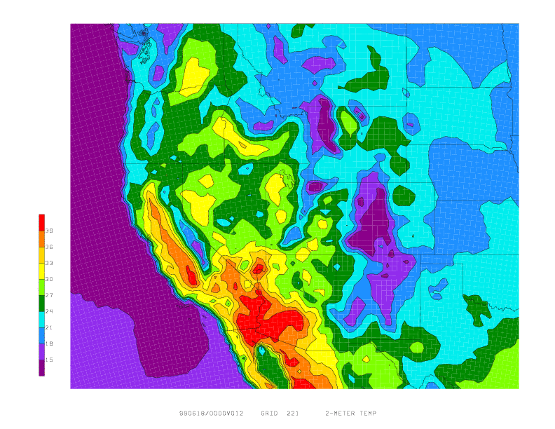
 Finally, this plot shows the same field on output grid #221
which has a resolution of 32 km. Slightly more detail than the
212 grid output is shown. (Larger differences between the 221
and 212 grids are seen for fields like 500 mb vorticity.)
Finally, this plot shows the same field on output grid #221
which has a resolution of 32 km. Slightly more detail than the
212 grid output is shown. (Larger differences between the 221
and 212 grids are seen for fields like 500 mb vorticity.)
If you use the AWIPS 80-km output grid, we are currently revisiting the issue of smoothing some of the fields on the grid 211. Click HERE for information.
For the archive of past tips of the month, click here