-- EMC Tropical Cyclone Forecast Verification --
Spatial Variation of Track & Intensity Errors
for Atlantic Storms (1995 - 1999)
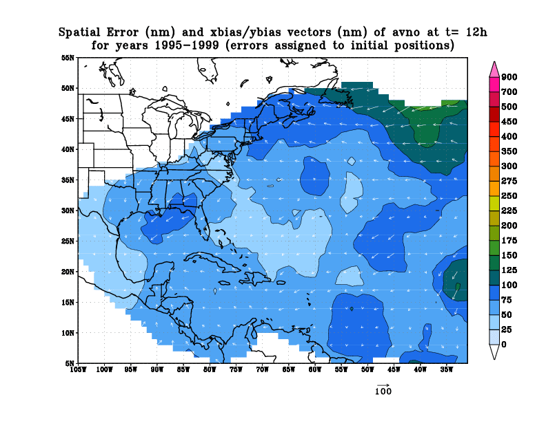
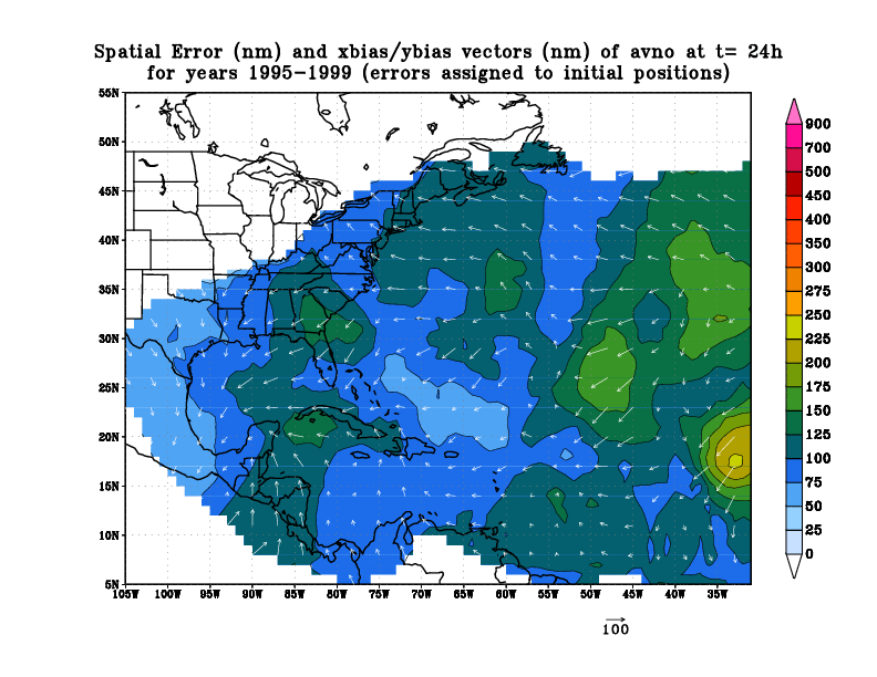
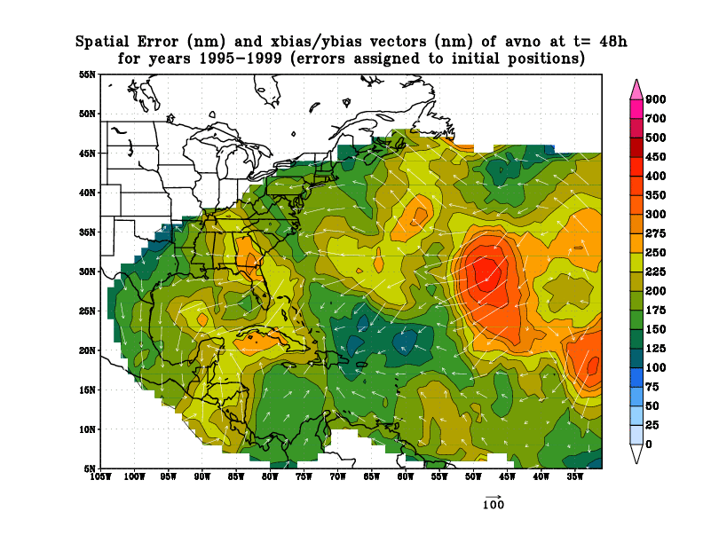
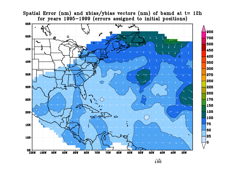
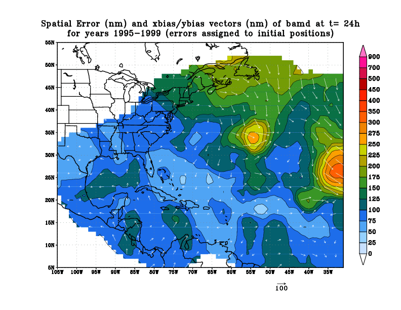
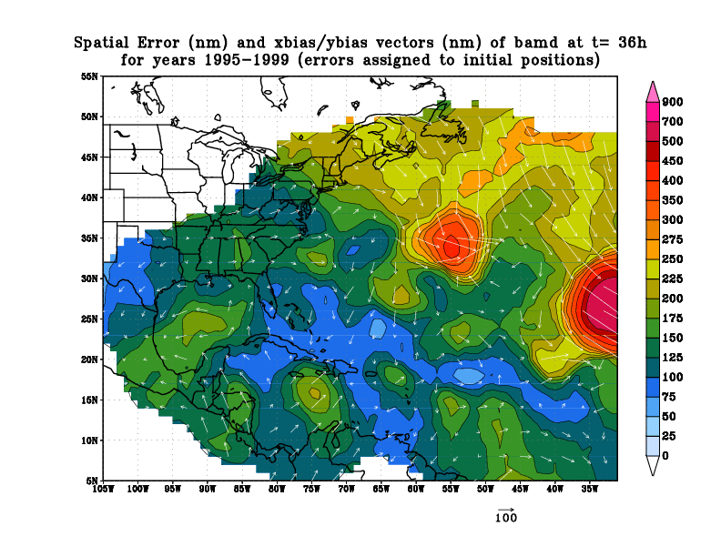
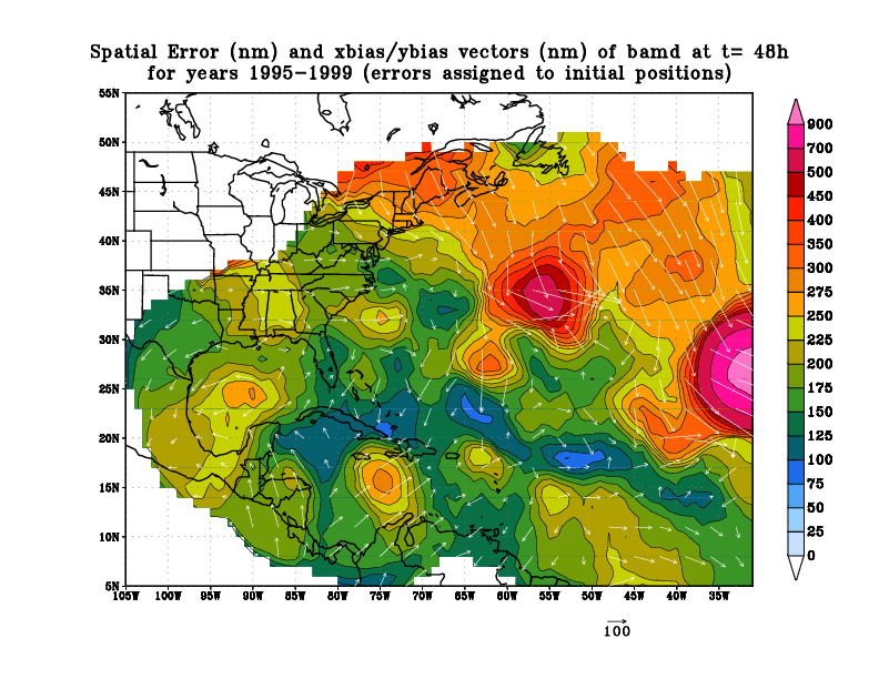
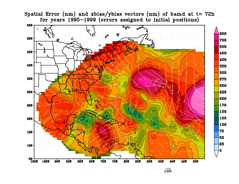
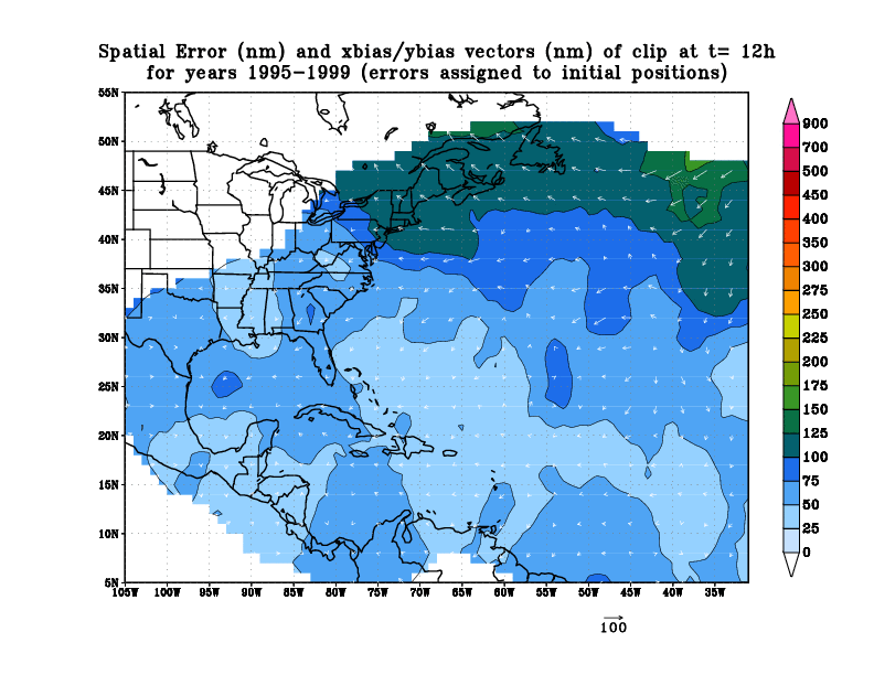
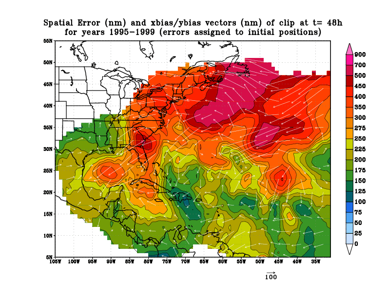
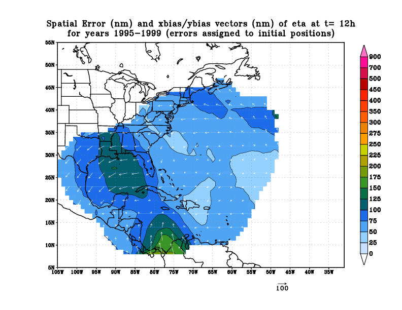
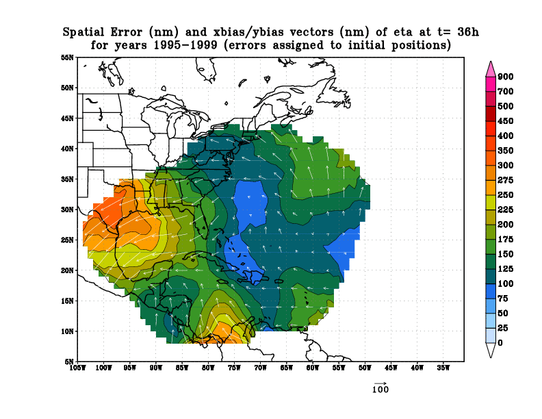
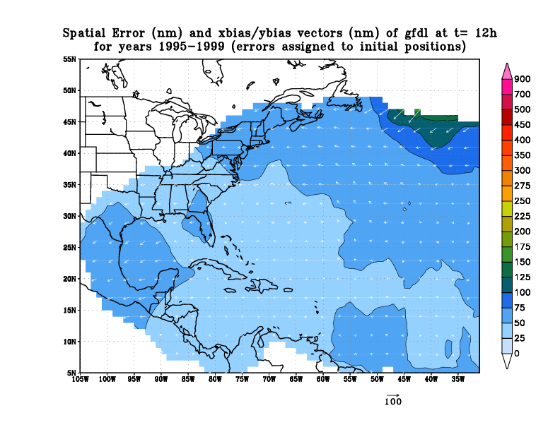
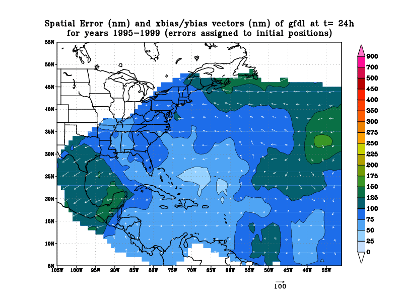
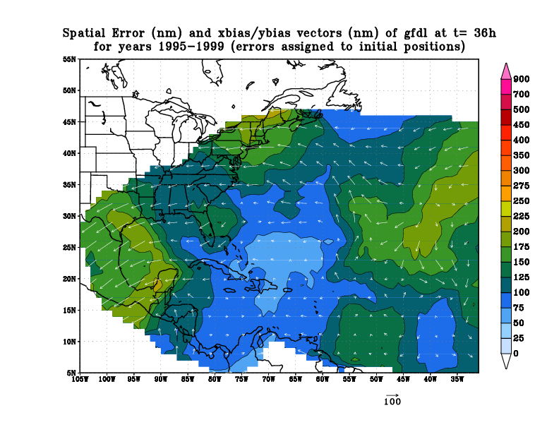
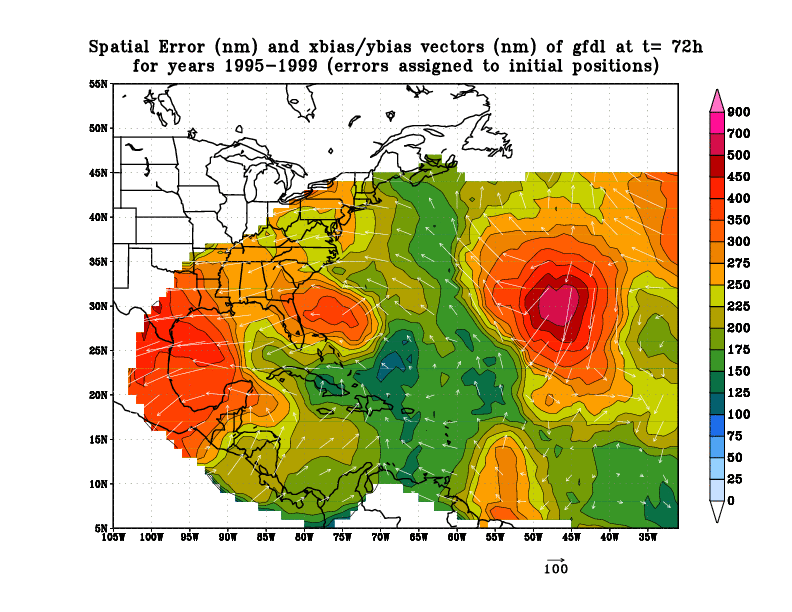
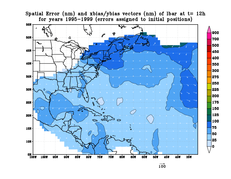
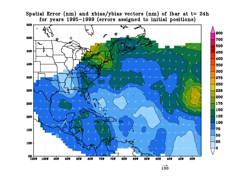
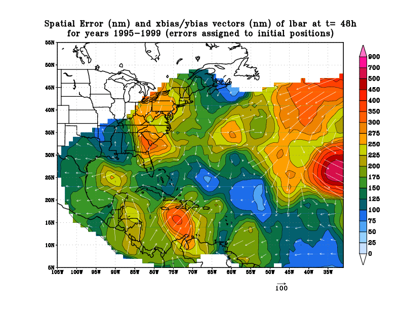
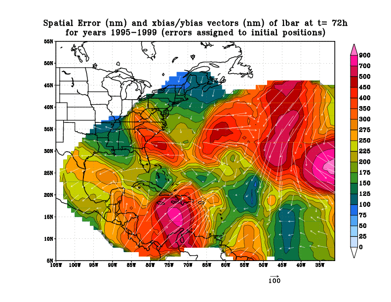
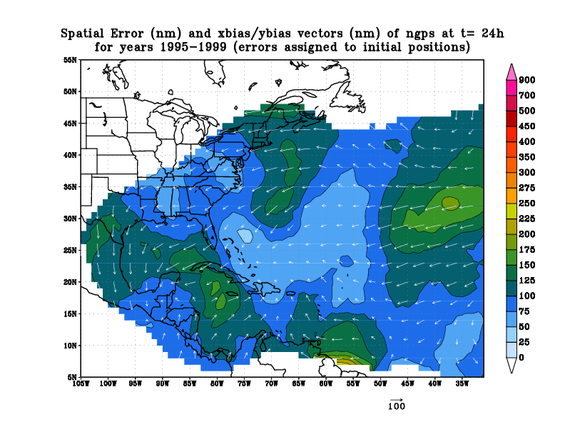
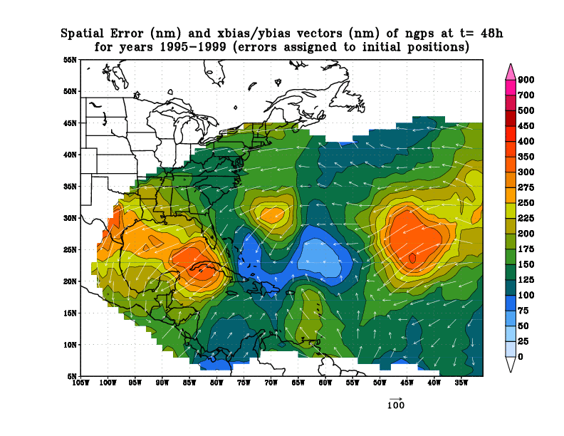
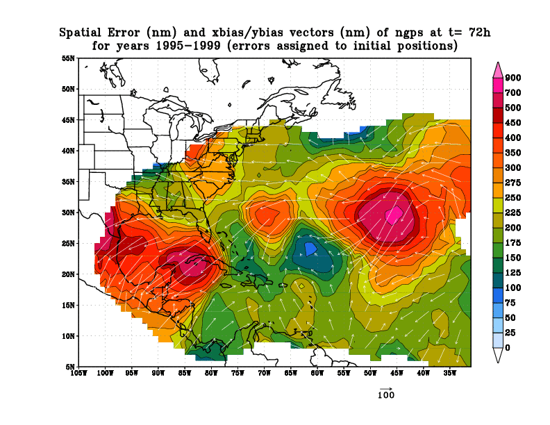
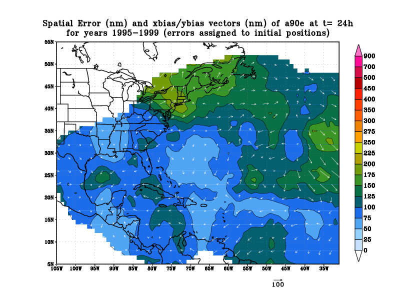
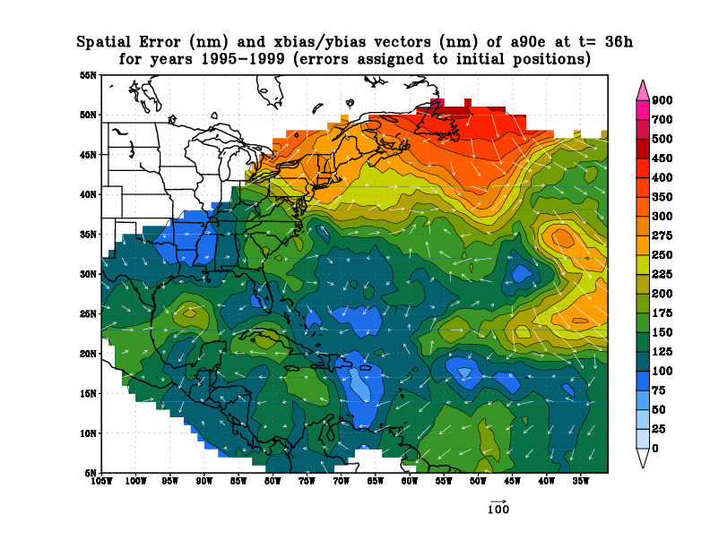
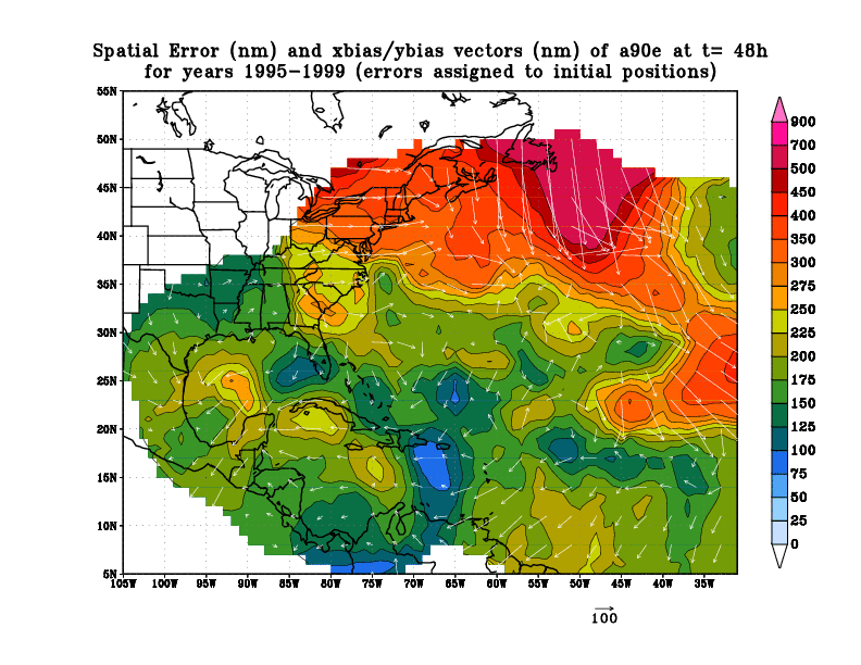
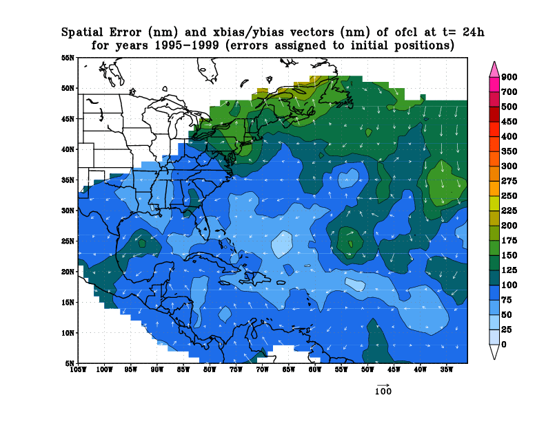
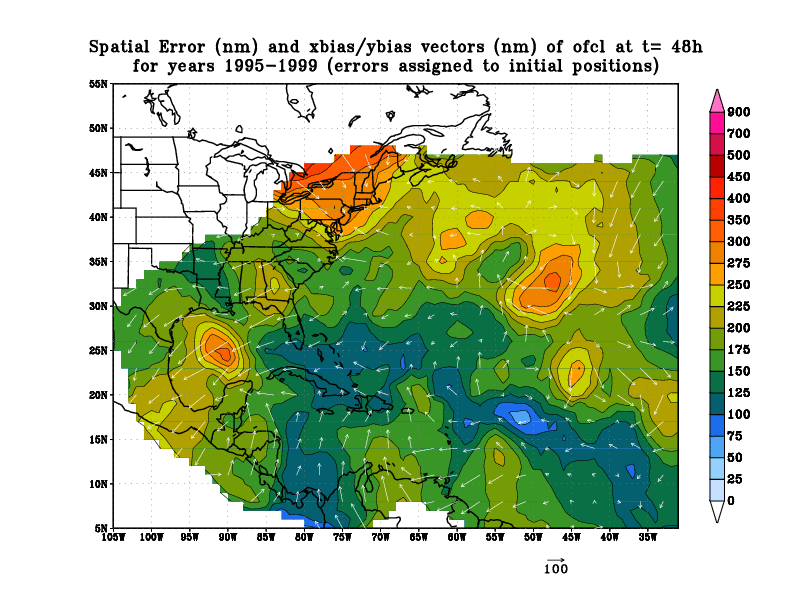
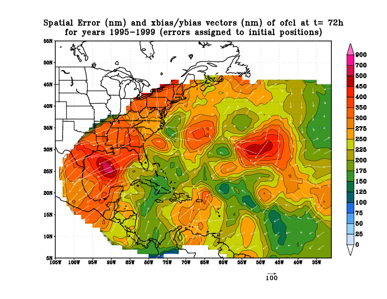
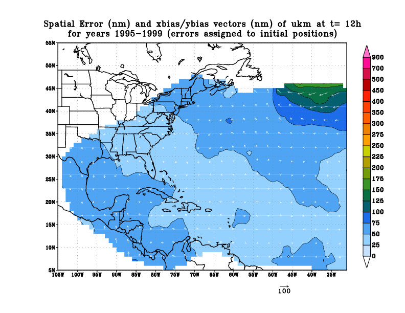
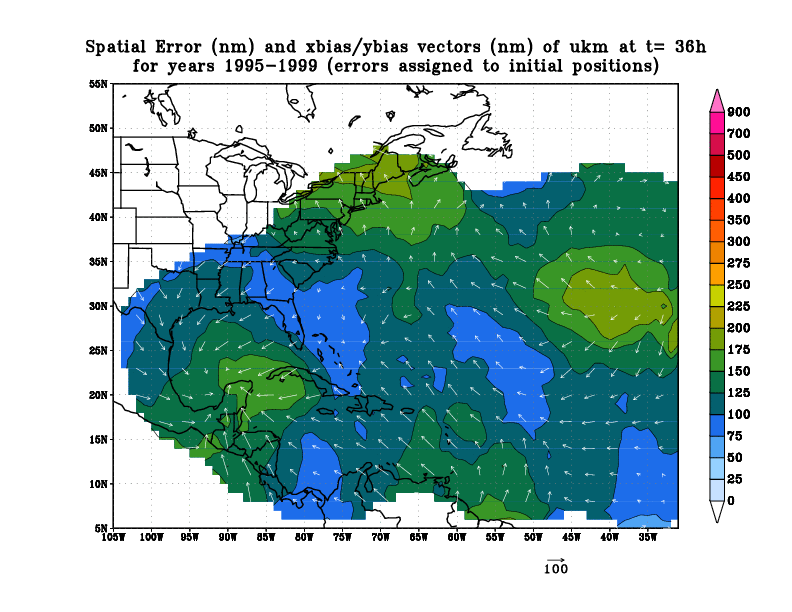
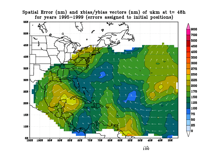
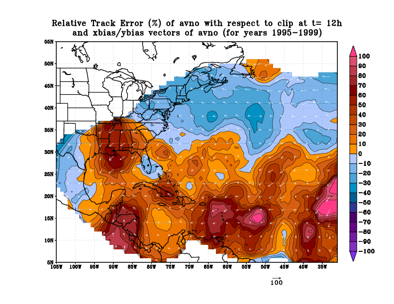
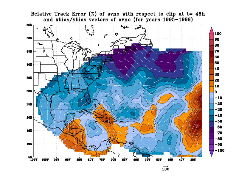
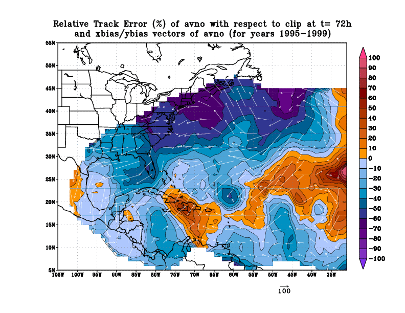
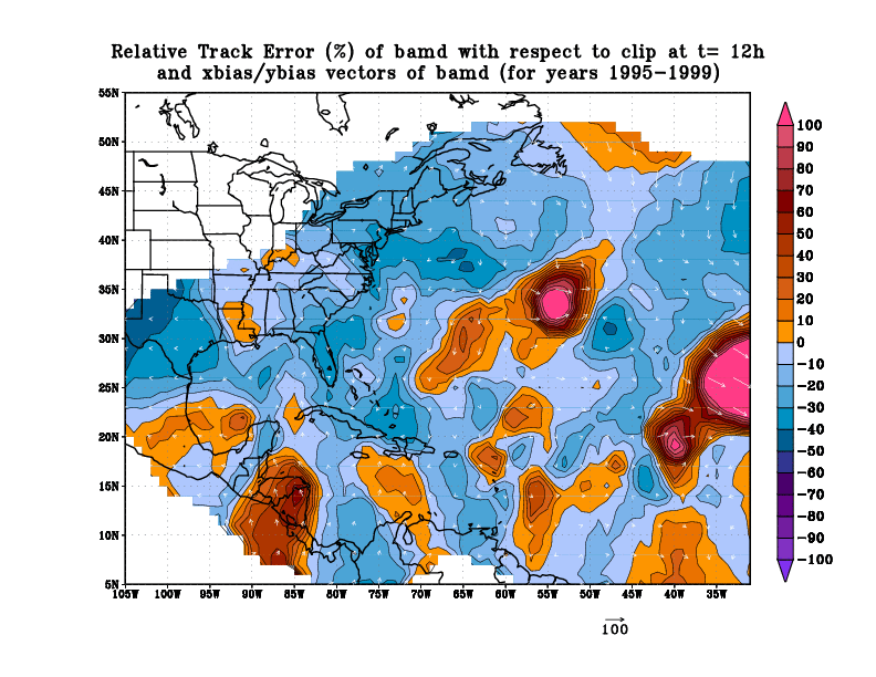
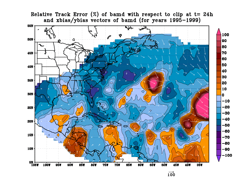
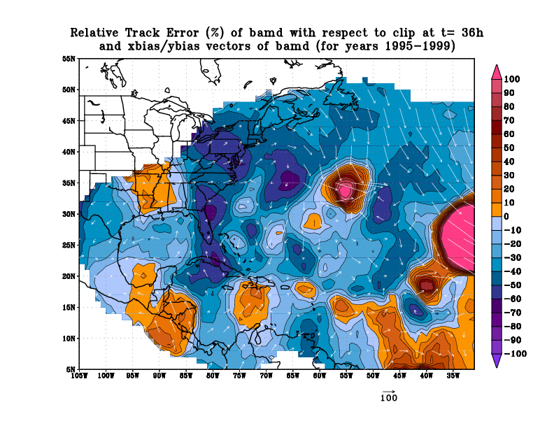
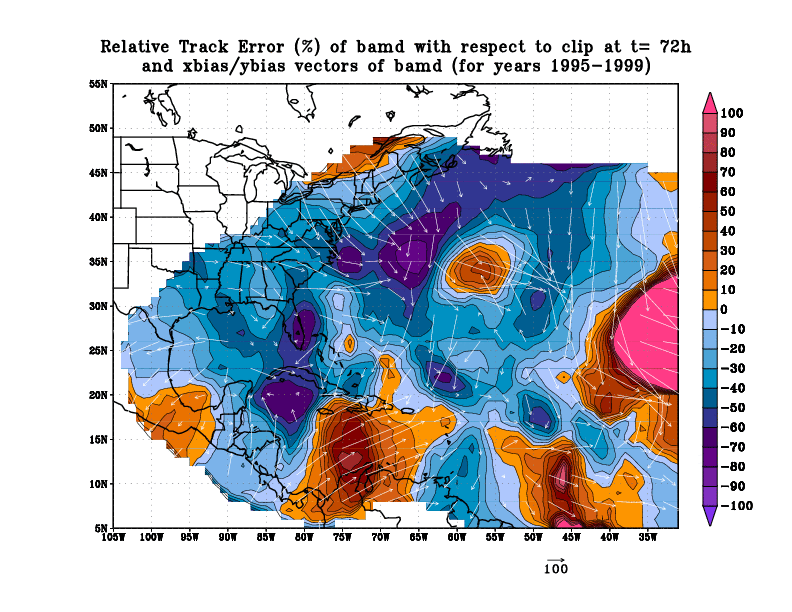
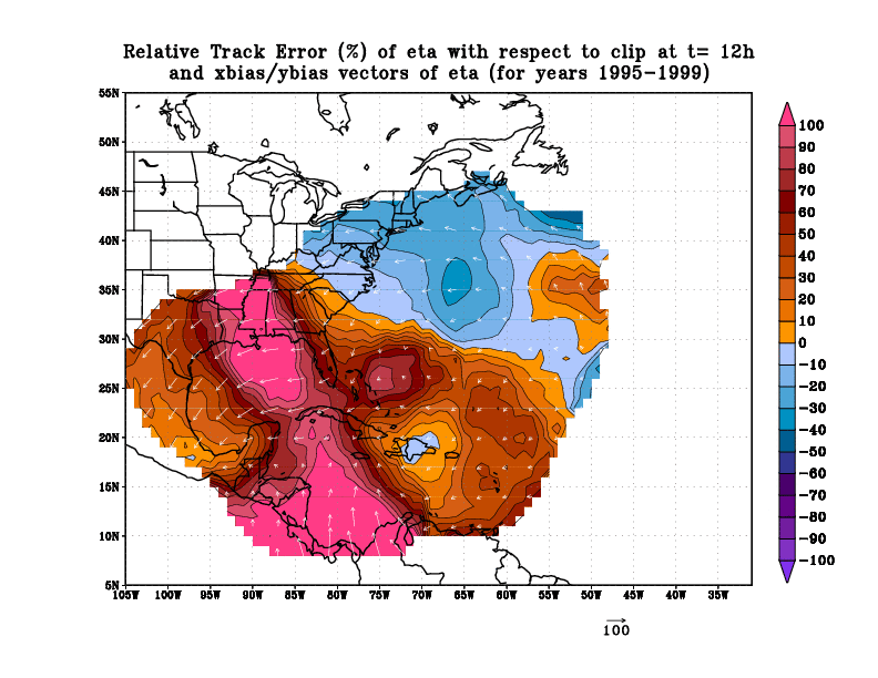
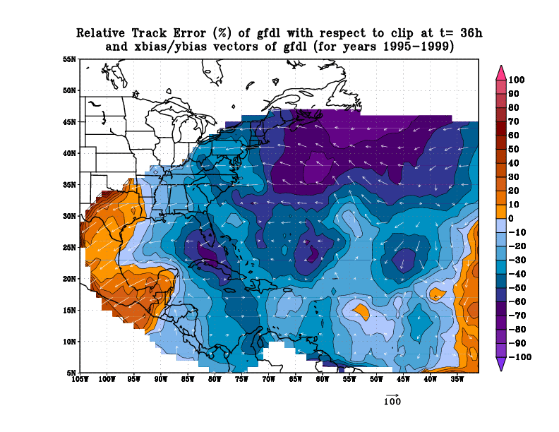
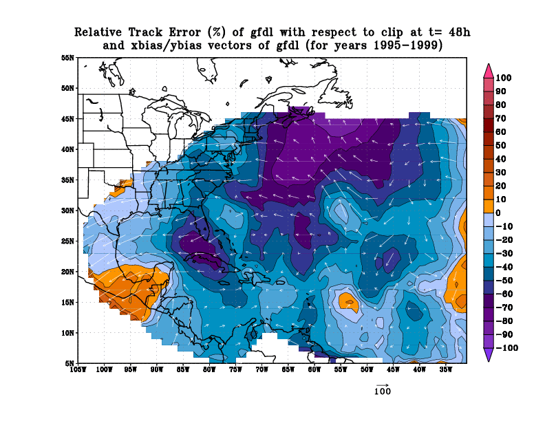
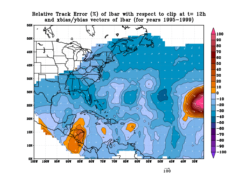
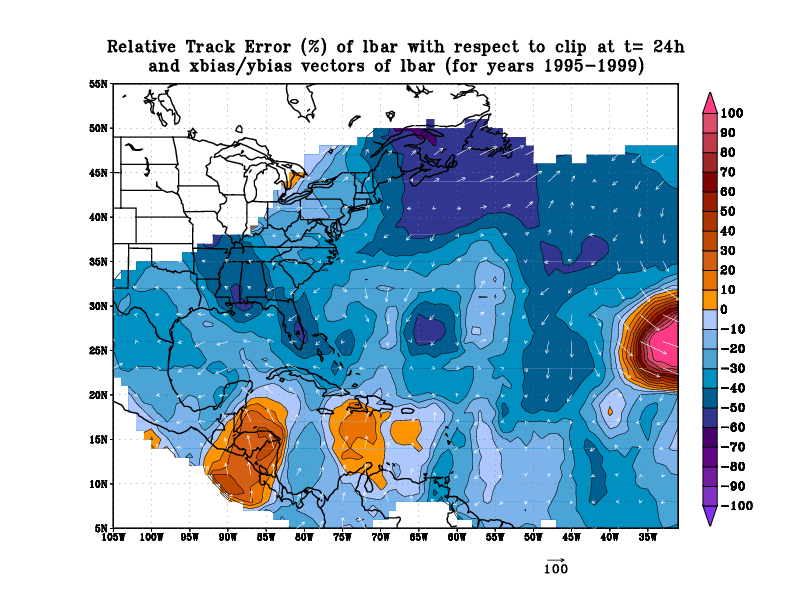
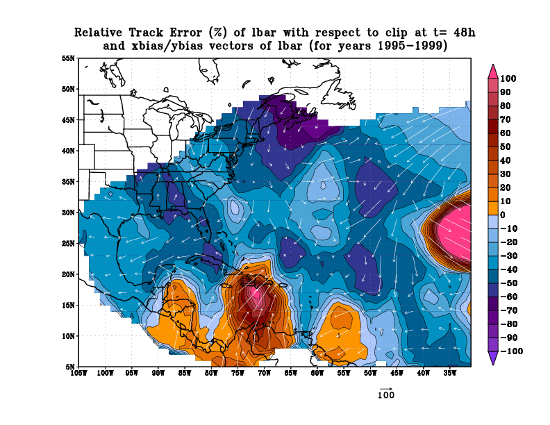
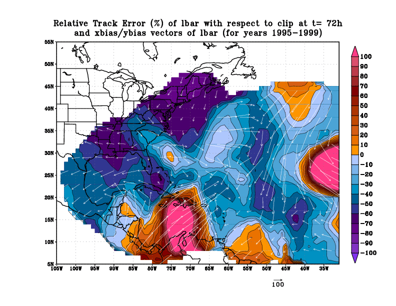
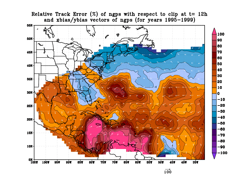
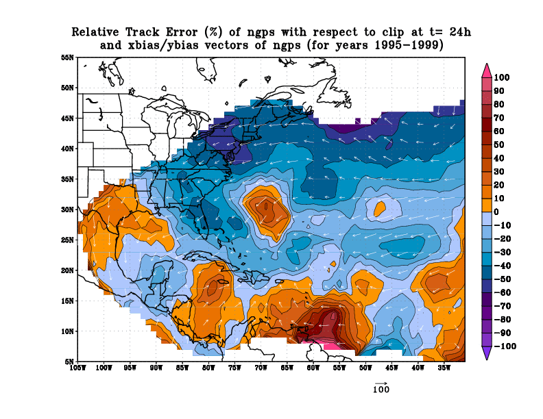
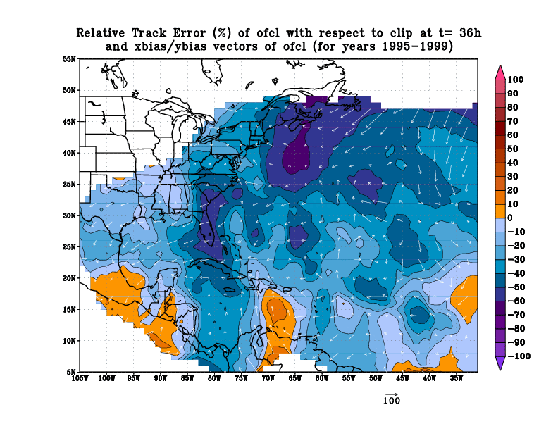
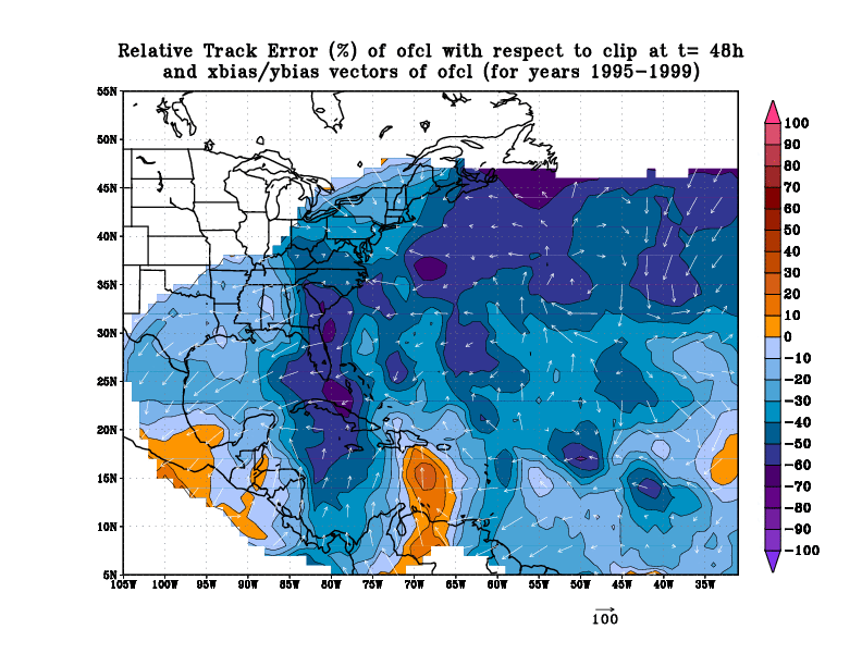
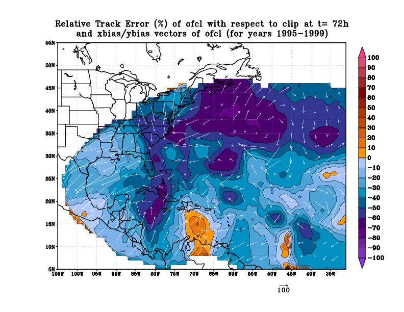
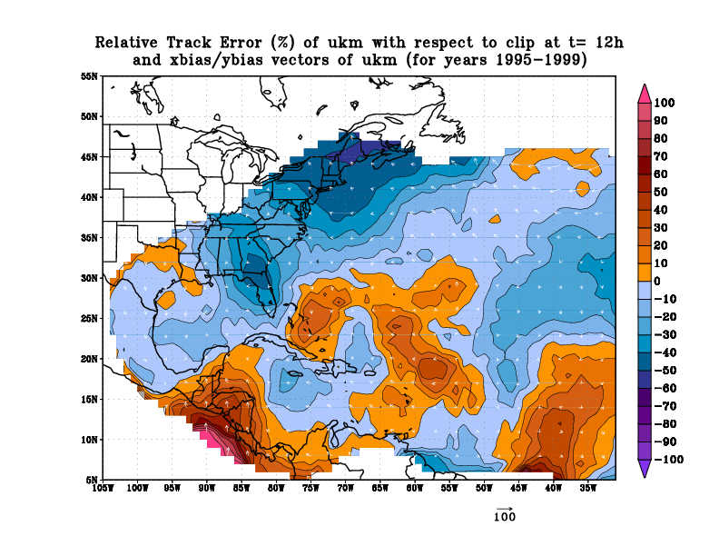
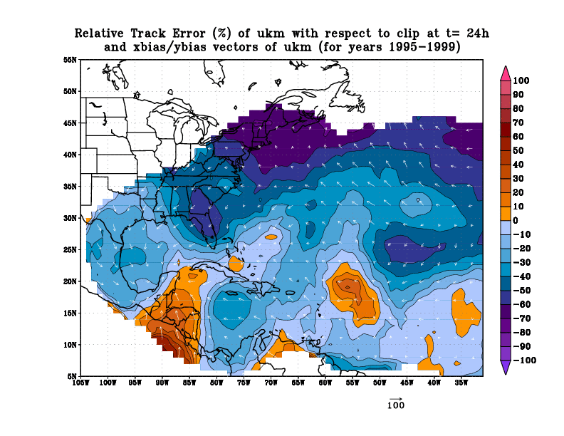
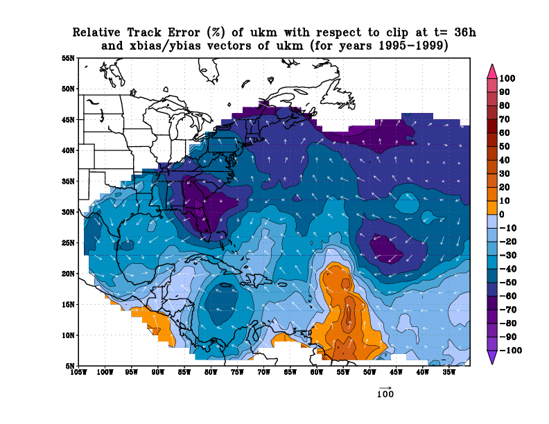
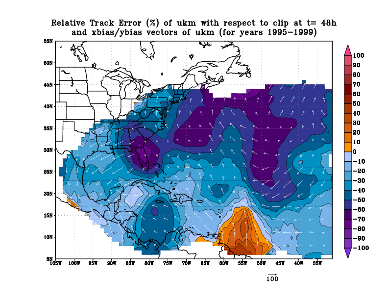
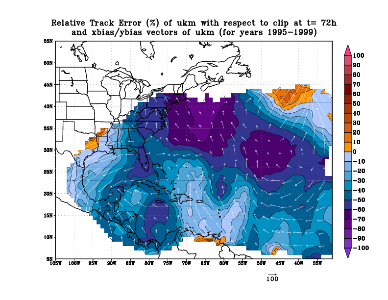
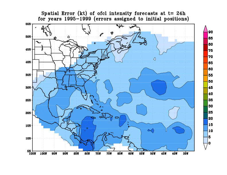
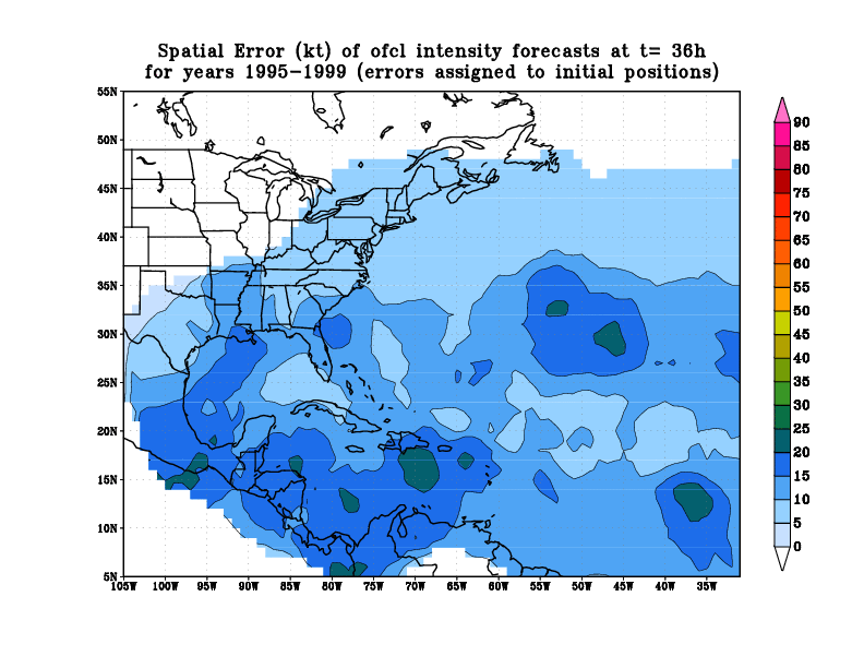
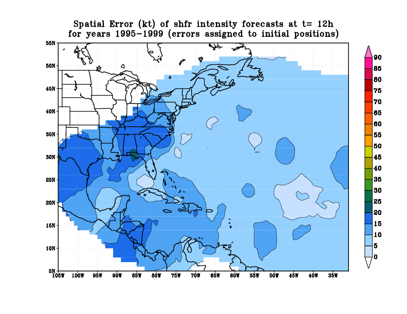
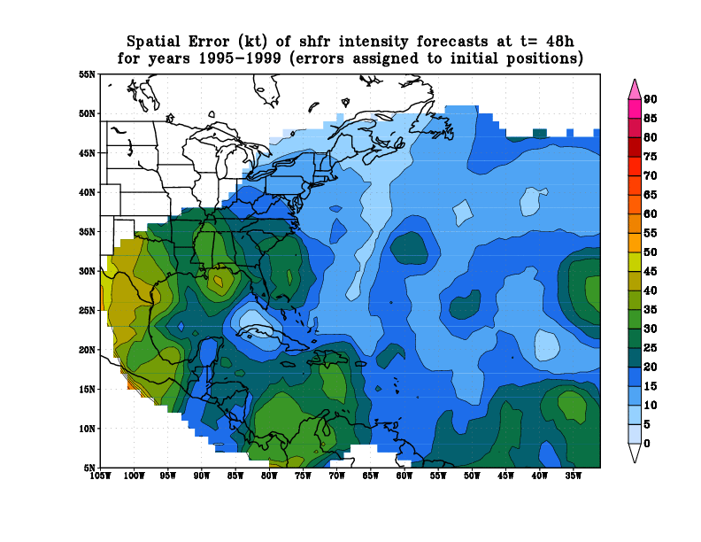
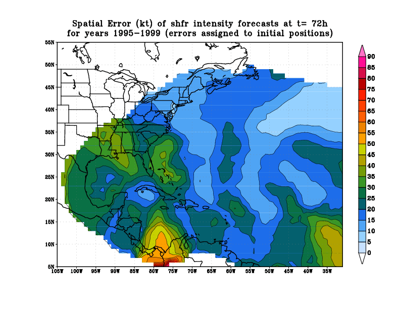
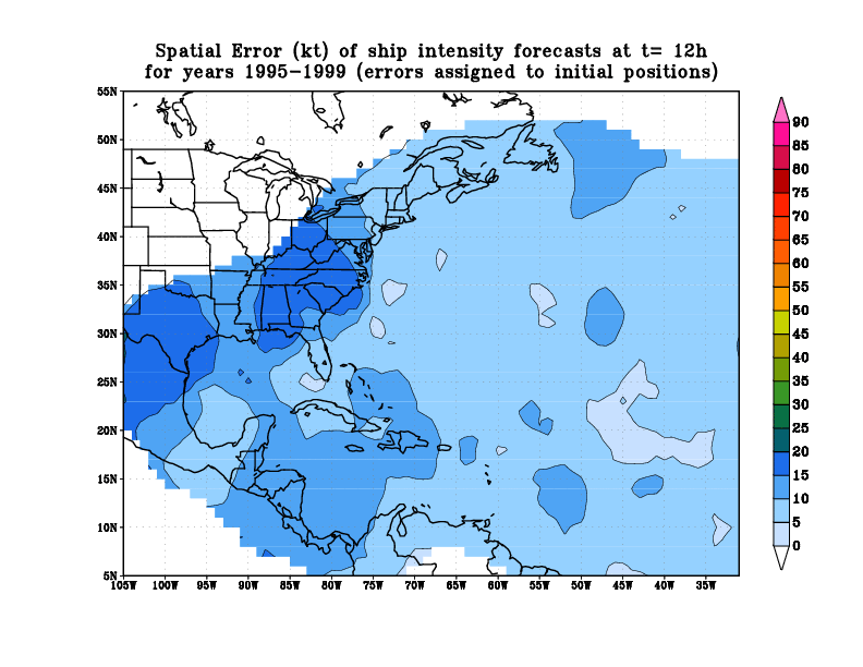
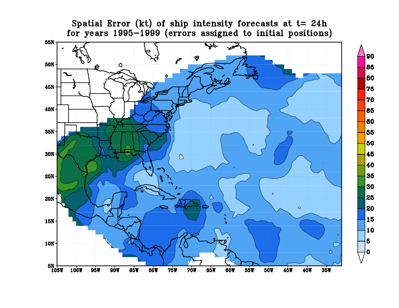
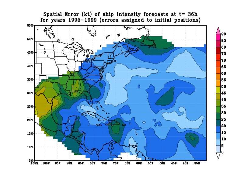
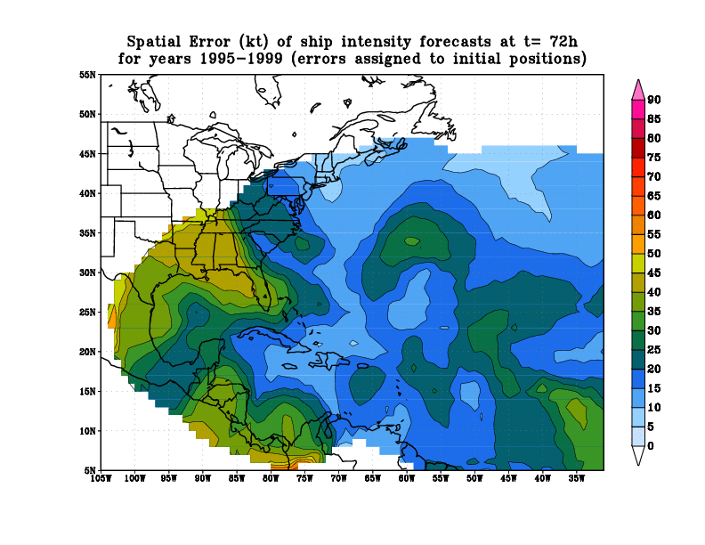
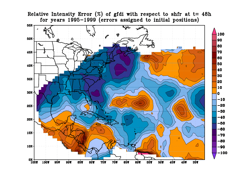
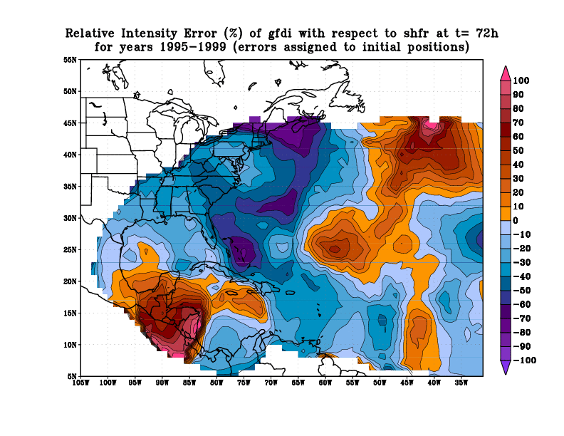
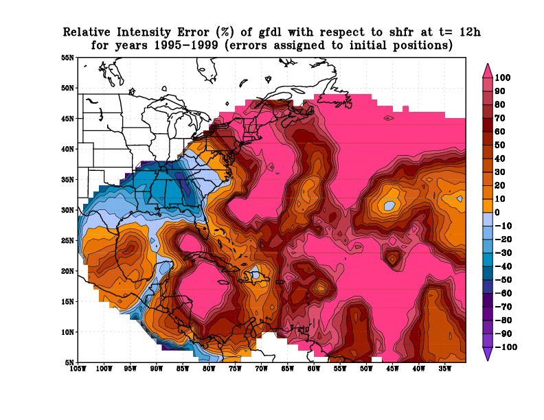
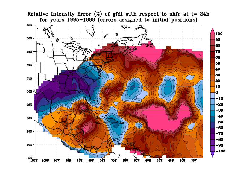
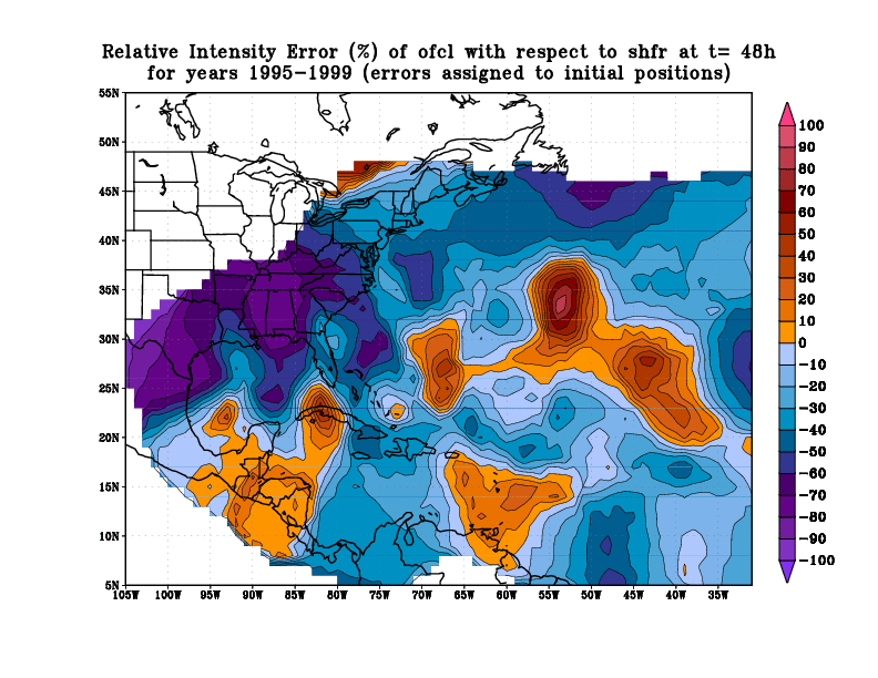
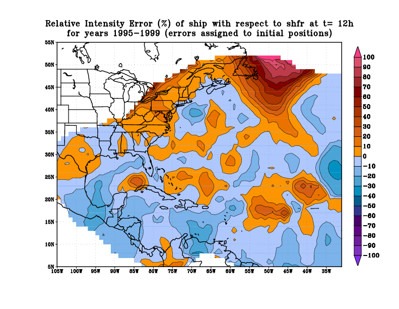
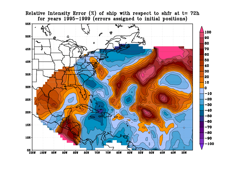
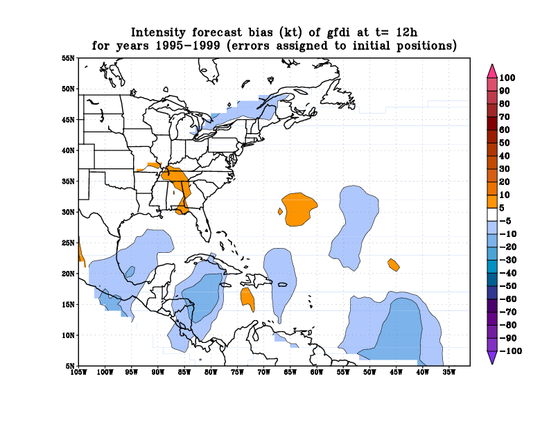
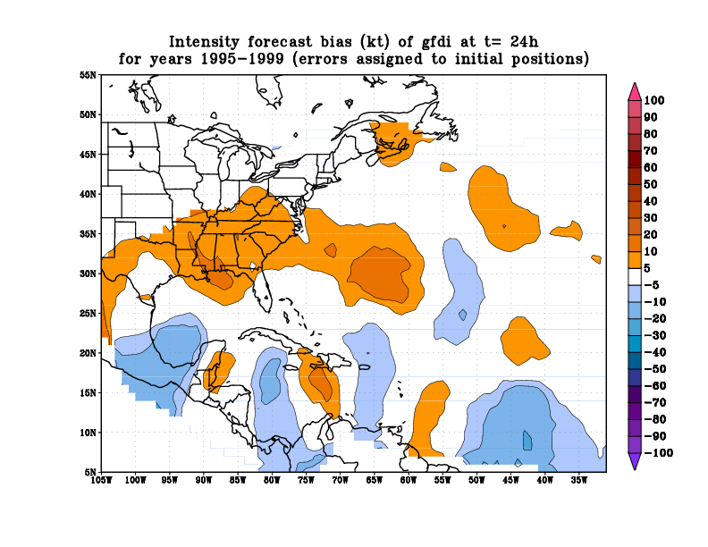
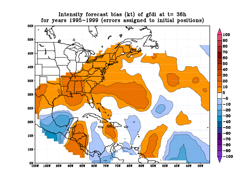
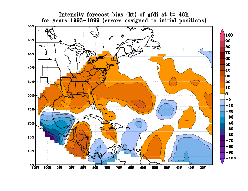
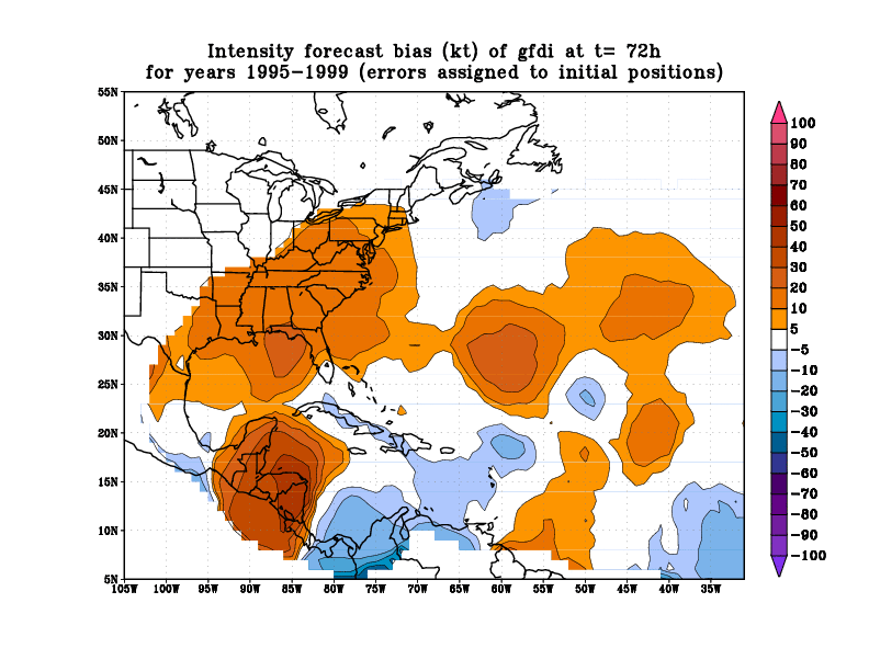
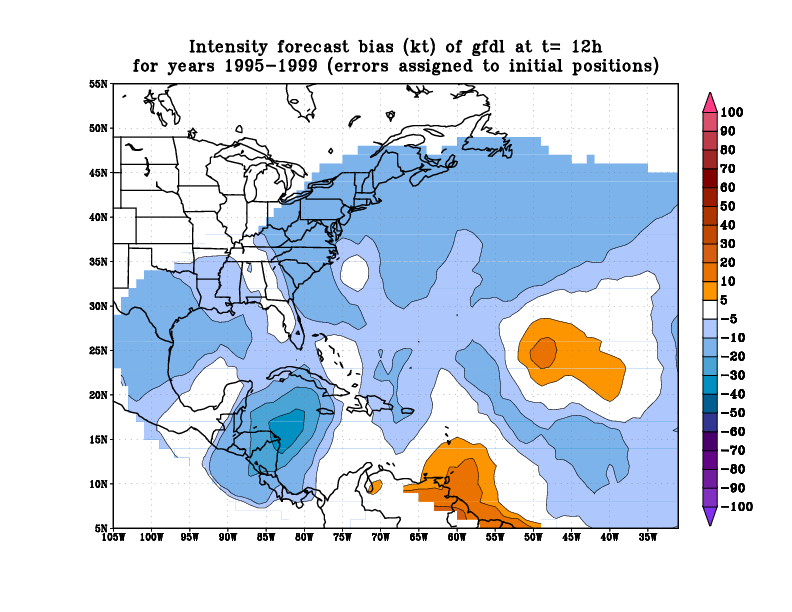
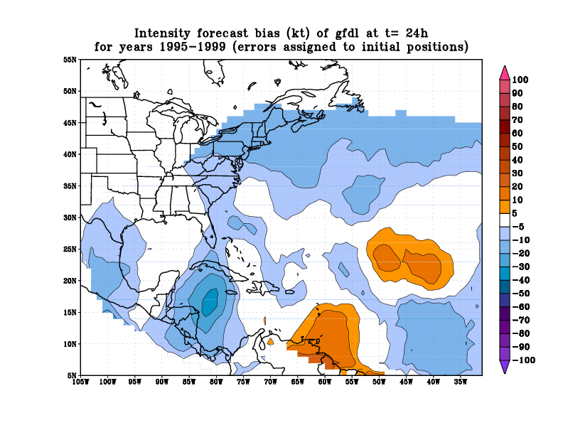
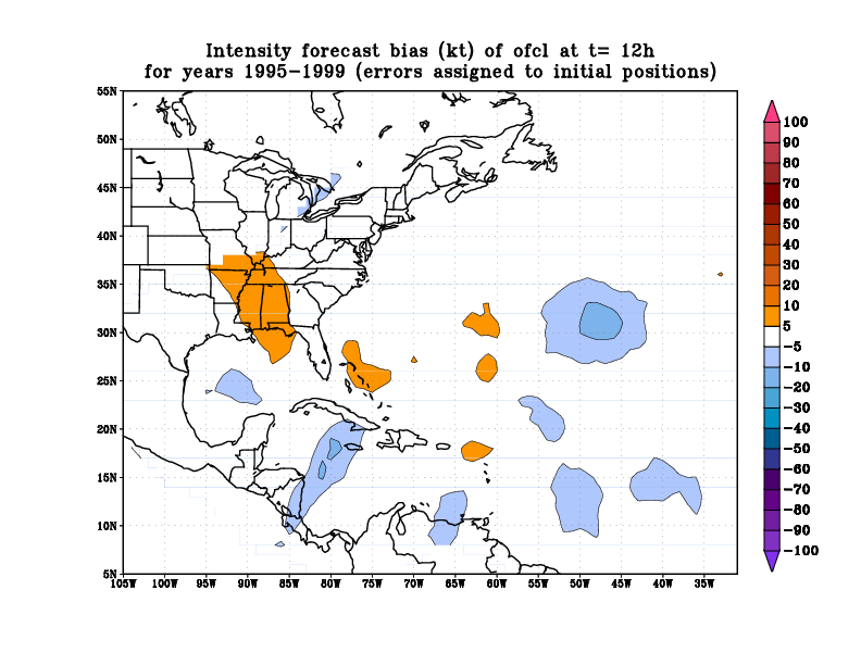
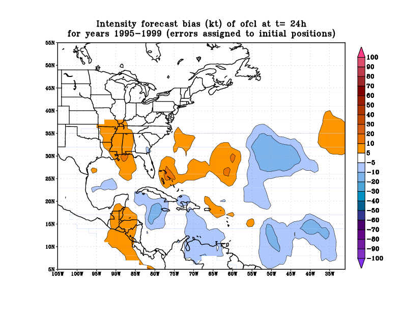
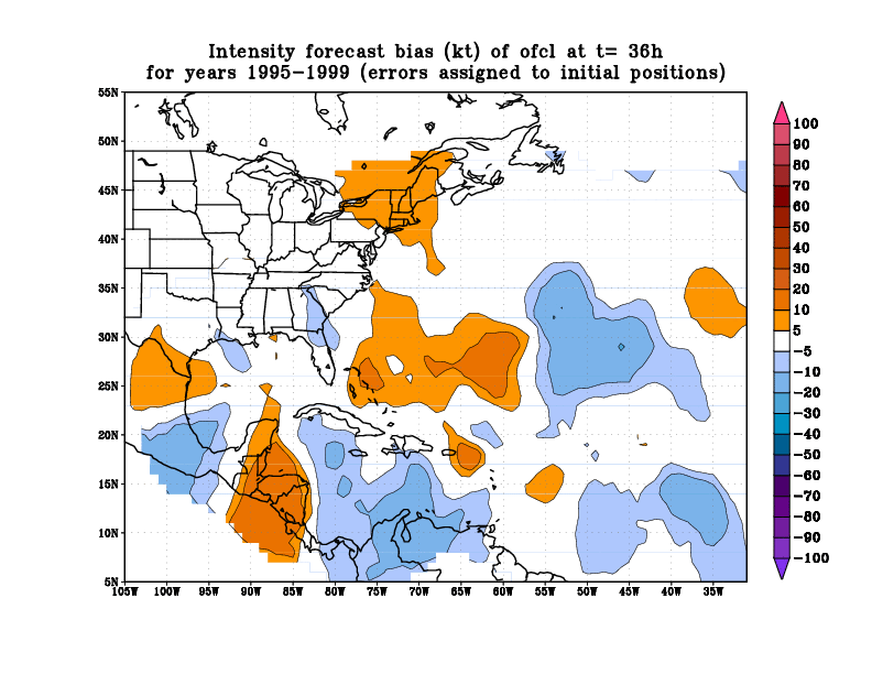
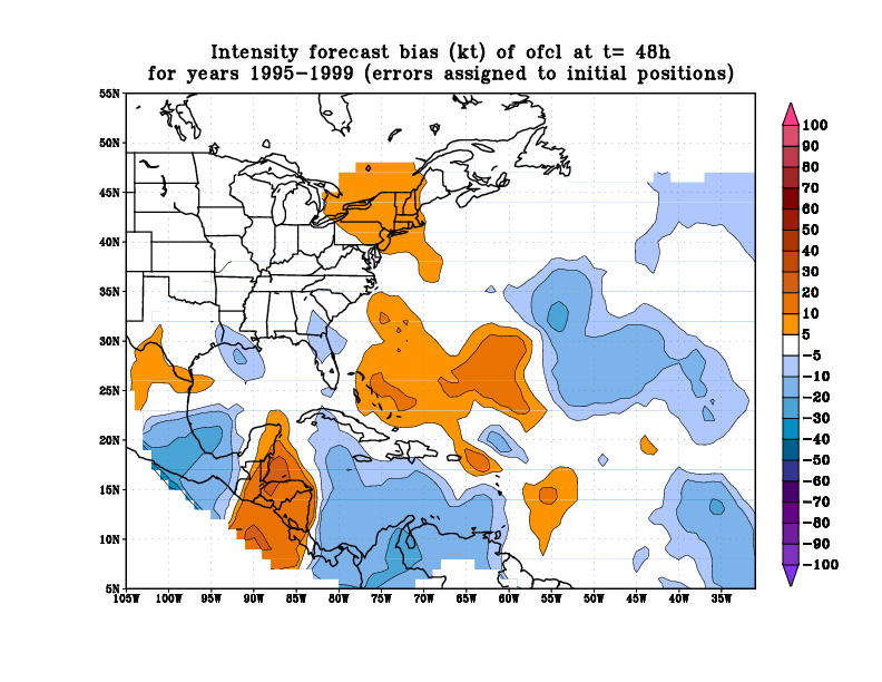
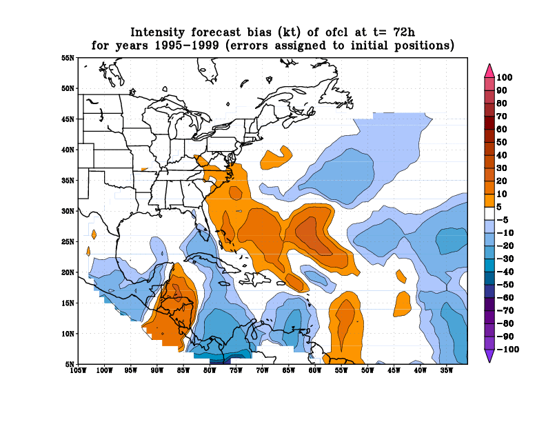
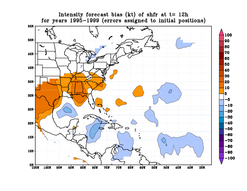
This page contains plots that show the spatial variation of
track and intensity forecast errors for various models and for
the official NHC forecast as well. The data used were the adecks
and bdecks from 1995 - 1999 for the Atlantic basin only. The software
used to do the verification is based on the code originally developed
by Jim Gross and Mark DeMaria. A Cressman analysis was added to the
code to provide the spatial analysis (this was suggested by Bob Tuleya,
who had done a similar analysis for GFDL forecasts previously).
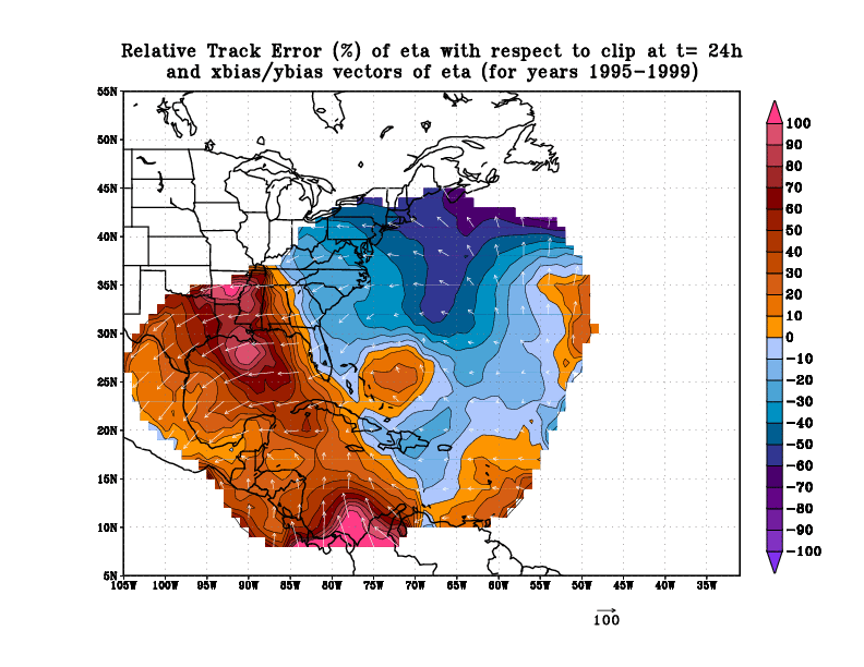
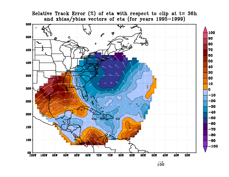
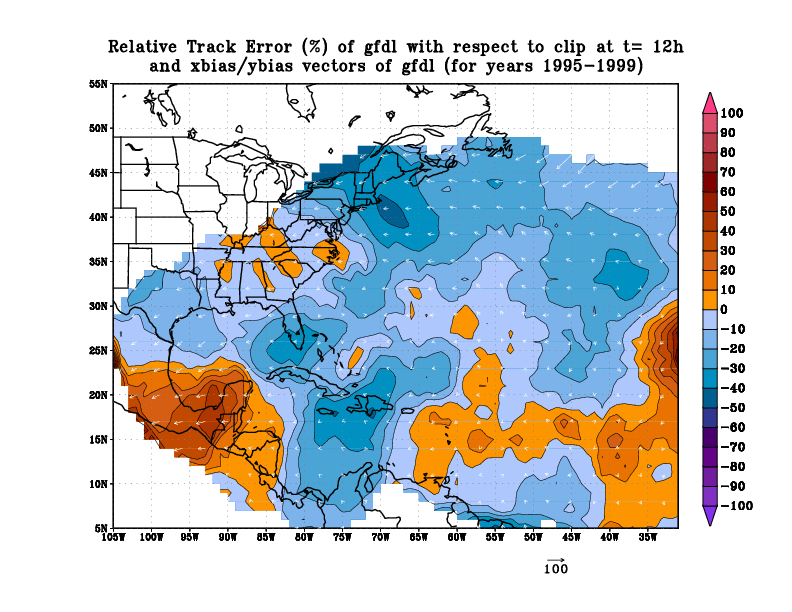
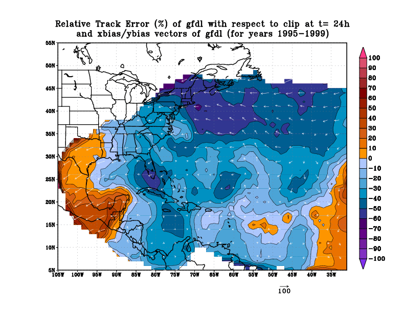
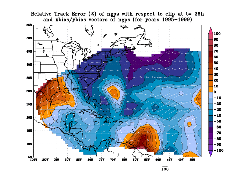
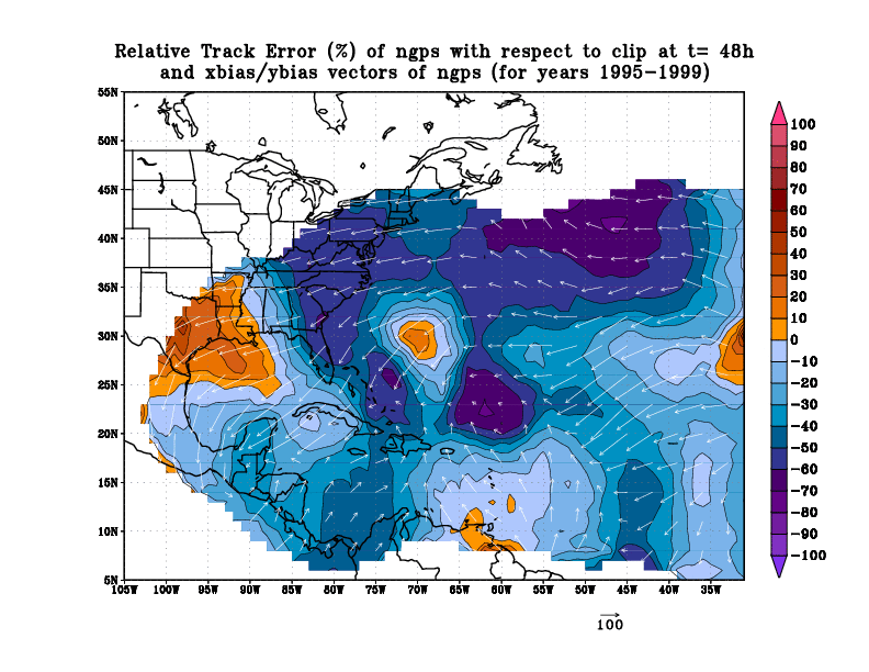
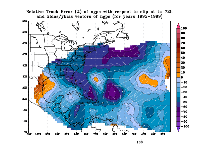
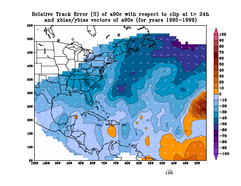
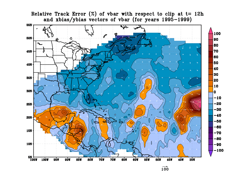
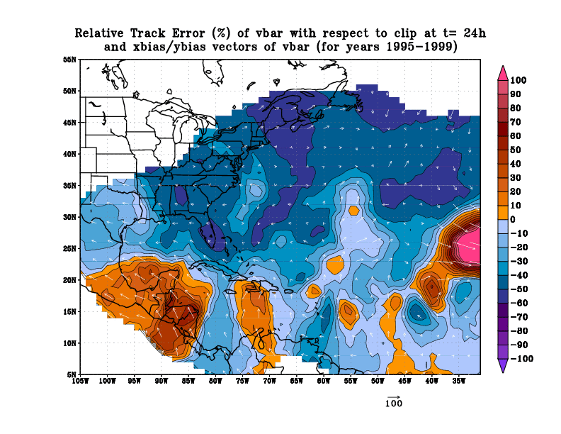
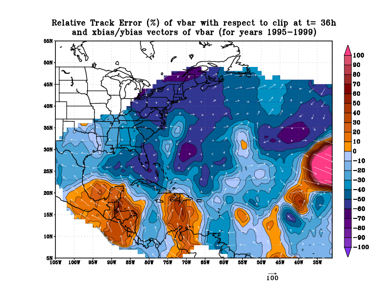
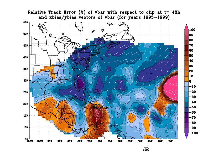
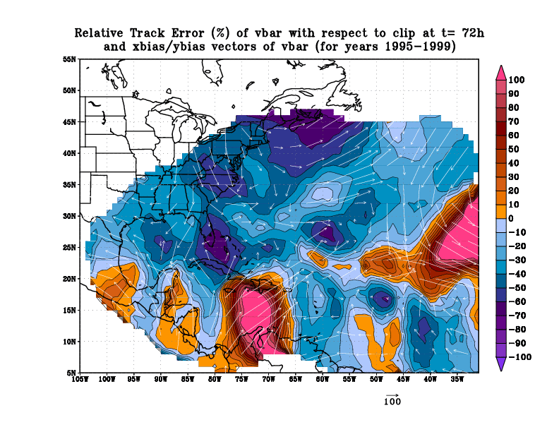
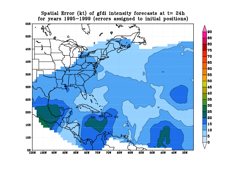
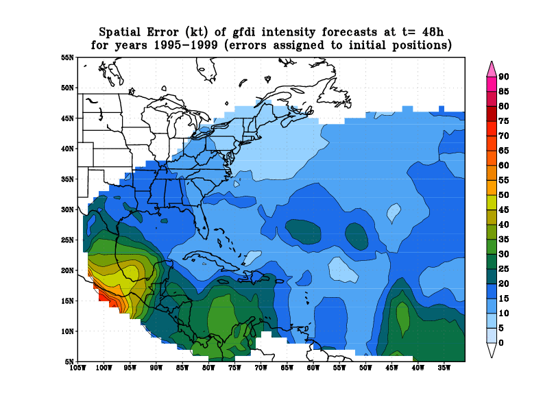
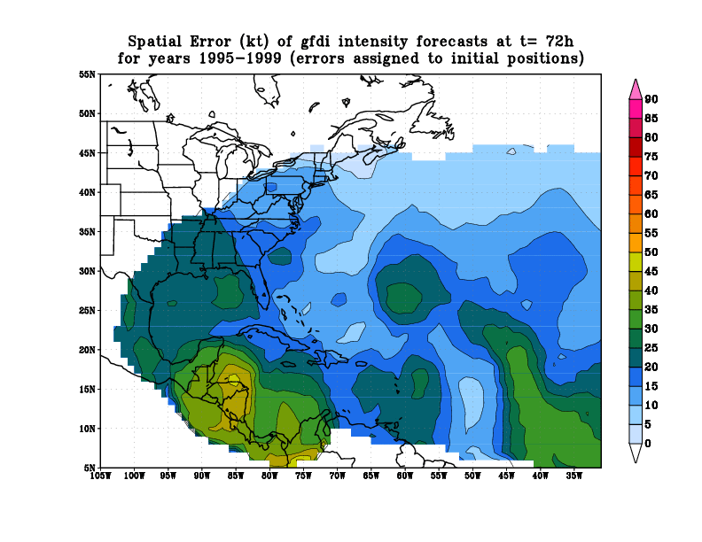
A few notes about these analyses and plots:
 The analysis is NOT homogeneous;
A separate analysis was done for each storm against CLIPER/SHIFOR.
A balance had to be found between homogeneity of the sample and
having enough data points for a valid Cressman analysis. If we had
done a homogeneous comparison, we would have had to throw out all of
1995, since we have no UKMET tracks from 1995. With this in mind,
these plots are most useful in identifying the strengths of
individual models on their own merit, and somewhat less useful for
doing inter-comparisons between different models for a specific
region.
The analysis is NOT homogeneous;
A separate analysis was done for each storm against CLIPER/SHIFOR.
A balance had to be found between homogeneity of the sample and
having enough data points for a valid Cressman analysis. If we had
done a homogeneous comparison, we would have had to throw out all of
1995, since we have no UKMET tracks from 1995. With this in mind,
these plots are most useful in identifying the strengths of
individual models on their own merit, and somewhat less useful for
doing inter-comparisons between different models for a specific
region.
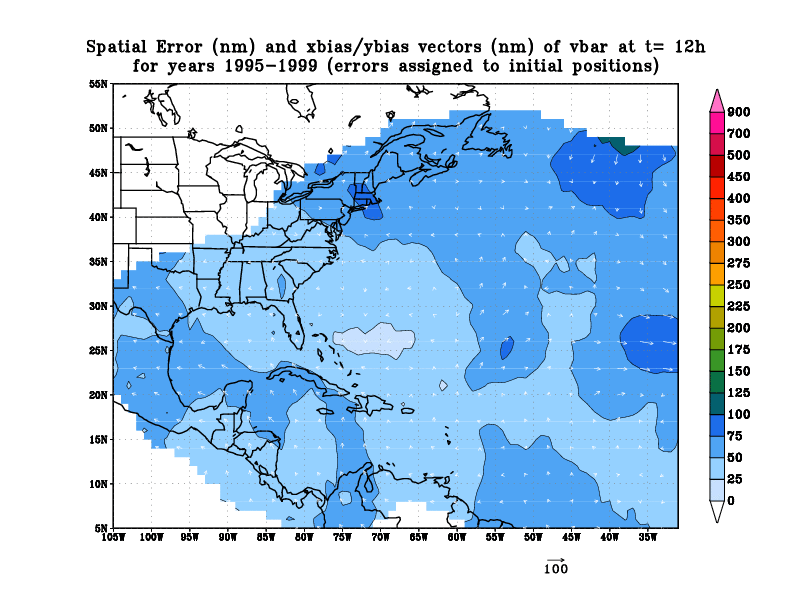
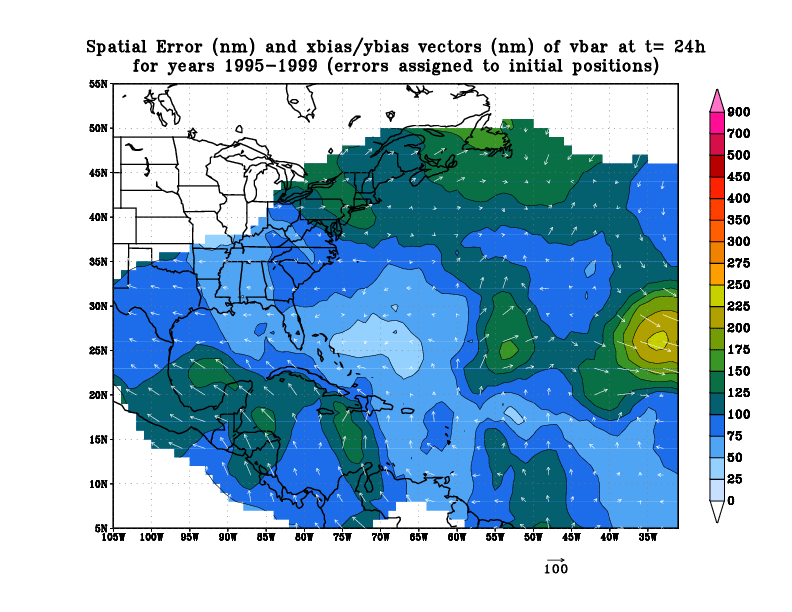
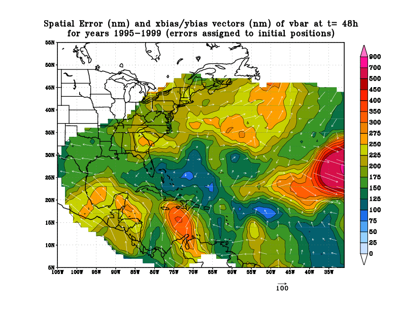
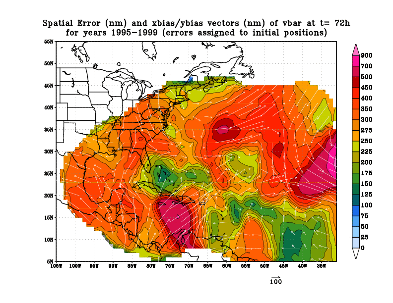
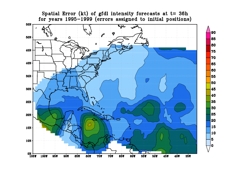
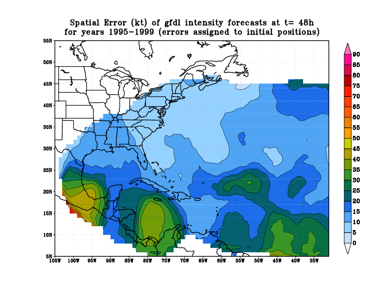
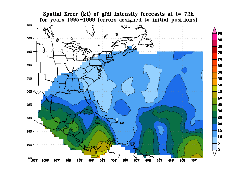
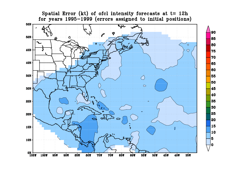
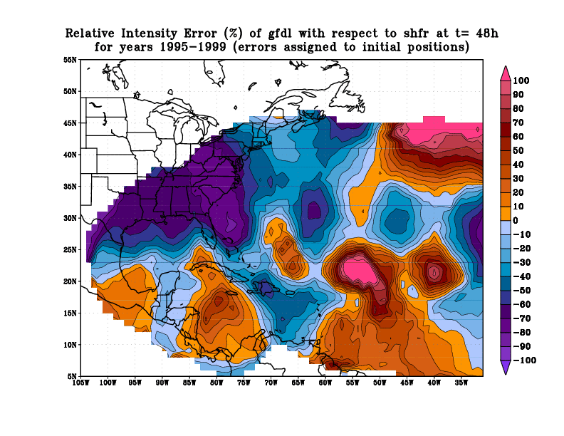
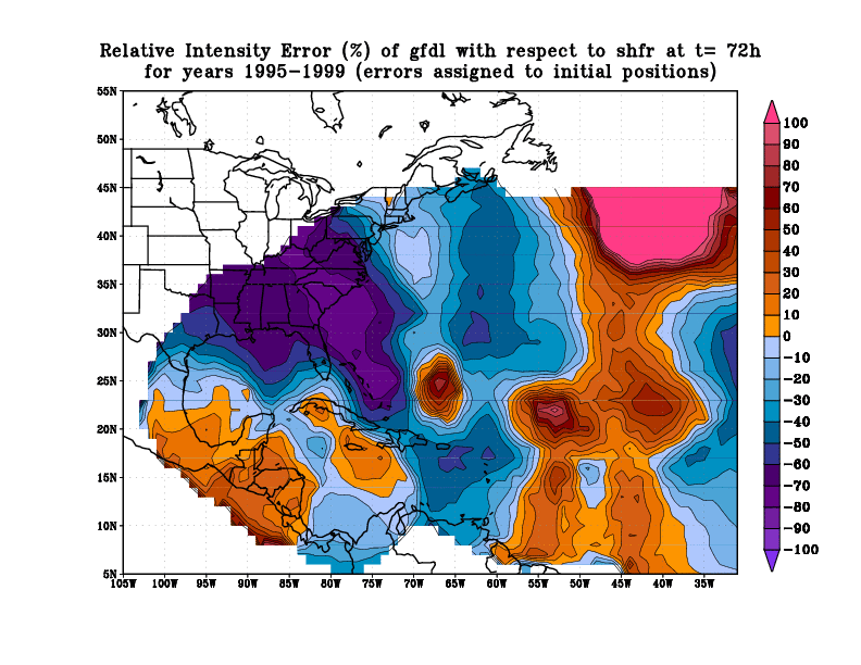
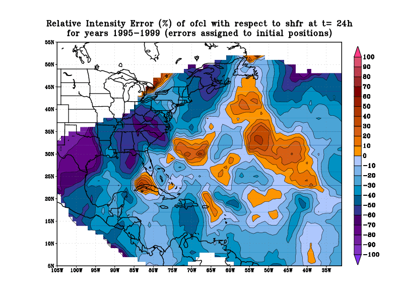
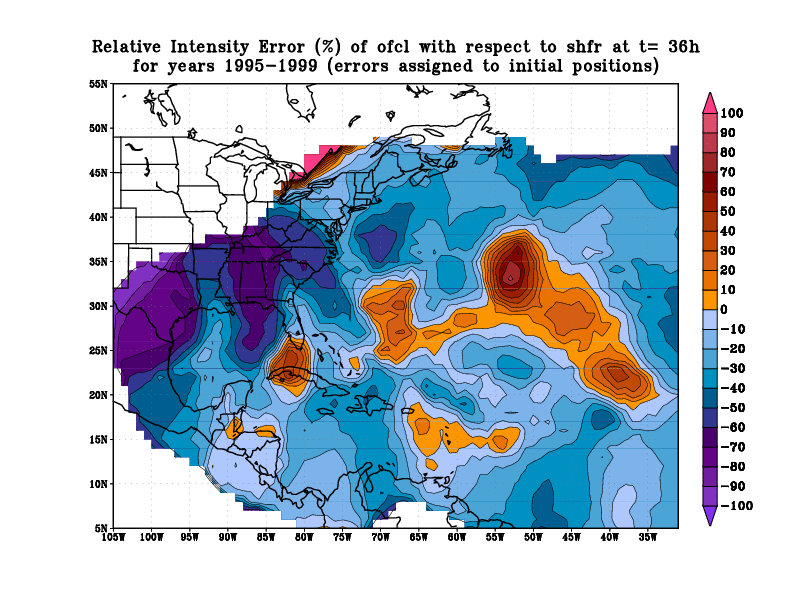
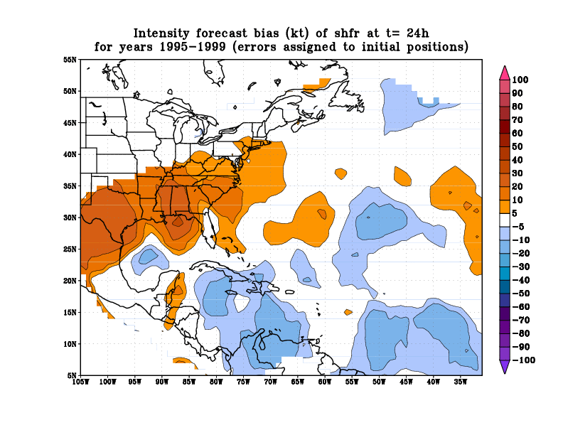
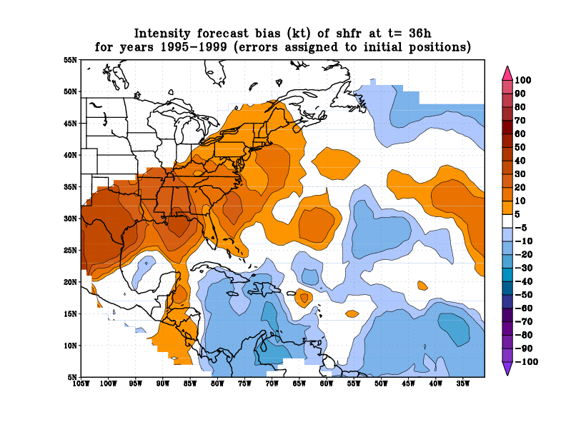
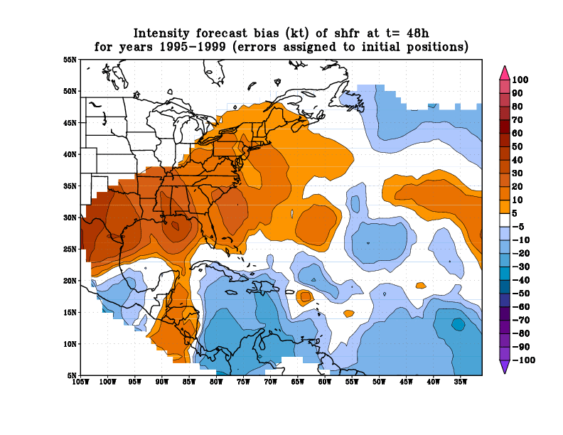
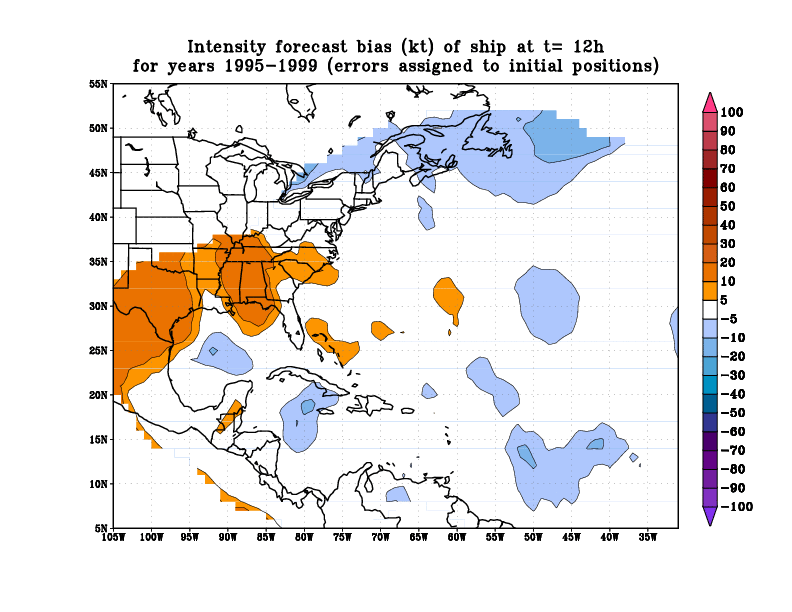
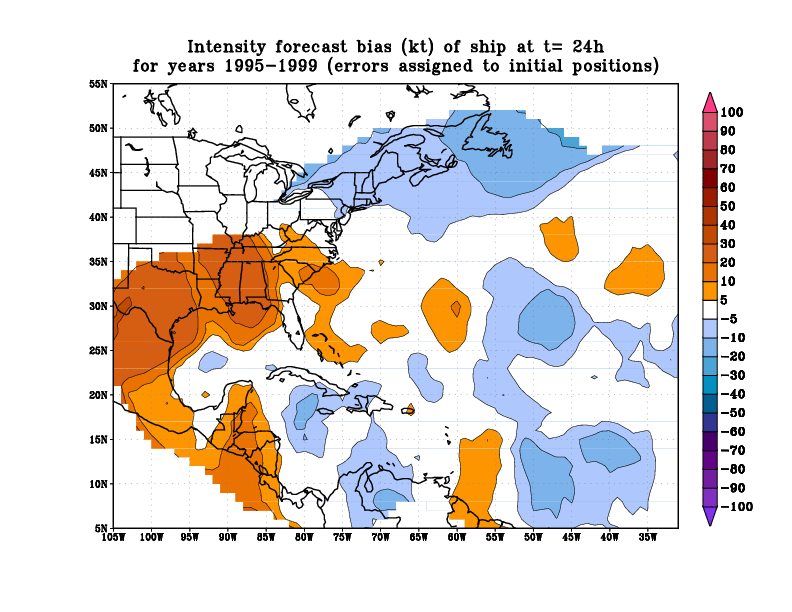
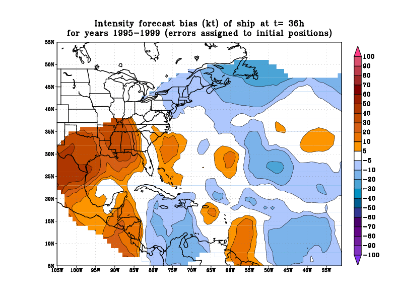
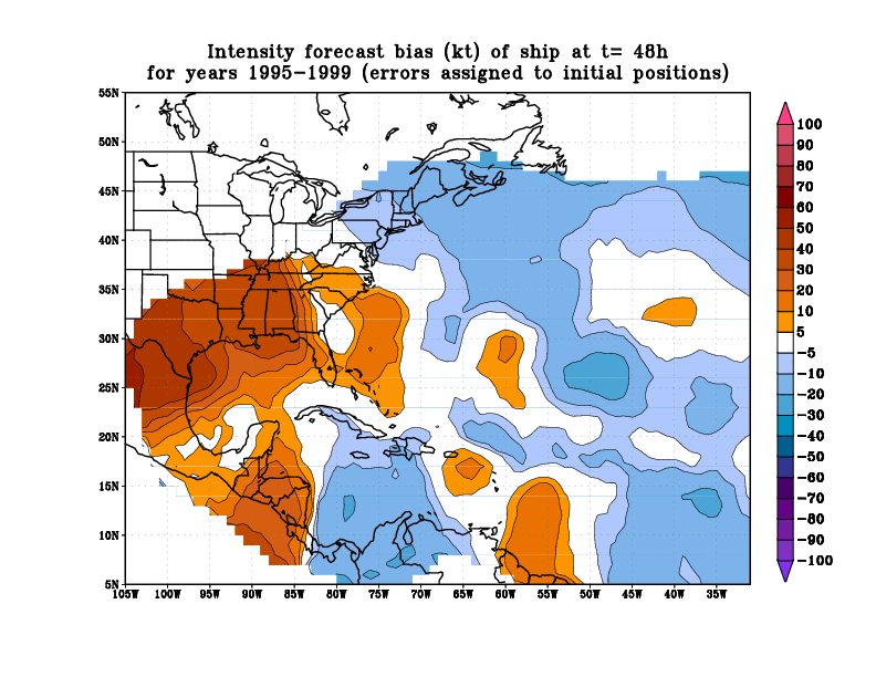
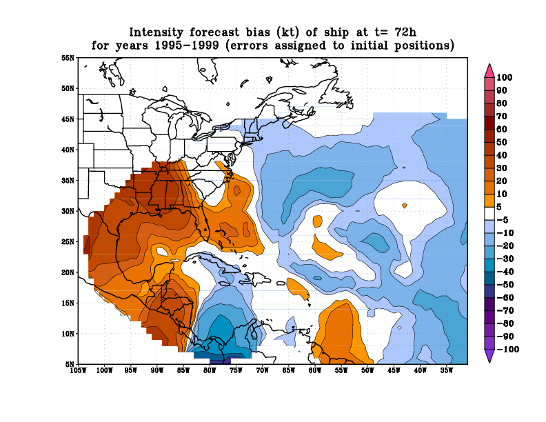
For the plots shown here, all
errors throughout each forecast were assigned to the initial
position of the storm for each forecast, as opposed to assigning
the errors to the verification positions (plots for a verification-
based analysis were also made, but are not shown here).
Spatial Variation of Track Errors
Spatial Variation of Track Errors
Relative to CLIPER (Skill)
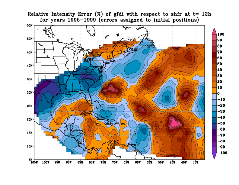
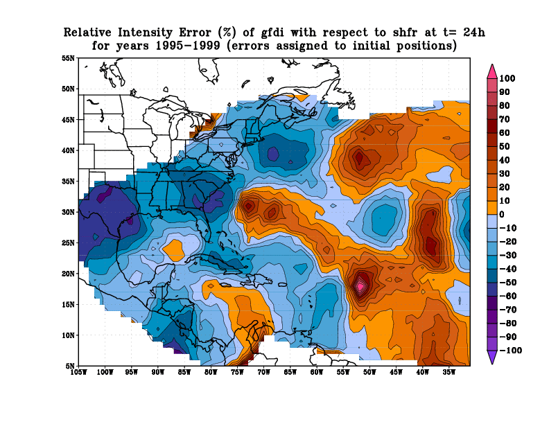
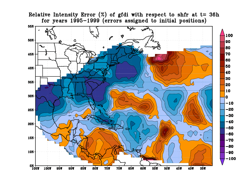
Spatial Variation of Intensity Errors
Spatial Variation of Intensity Errors
Relative to SHIFOR (Skill)
Spatial Variation of Intensity Bias
Subjective Interpretation
With any questions/suggestions about this page, please contact:
Tim Marchok Timothy.Marchok@noaa.gov
Bob Tuleya rt@gfdl.gov
Steve Lord Stephen.Lord@noaa.gov
Date last updated: 03/10/2000