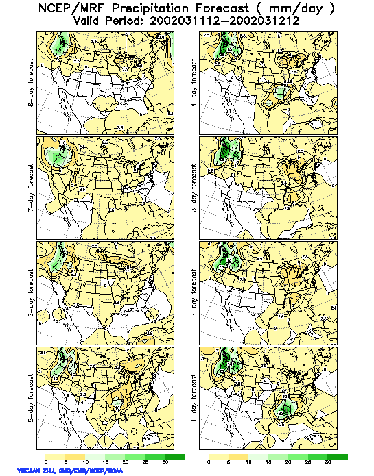
It is well known that forecast skill can vary dramatically from case
to case. An example for such variations can be seen when the MRF high resolution
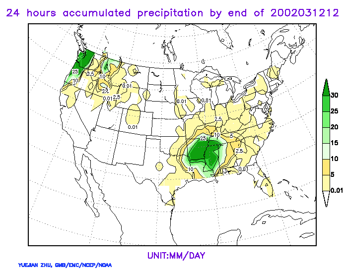
control QPF forecasts verifying for the 24-hour period
02031112-02031212 are compared to the verifying raingage-based
QPE. While at 1-day lead time the QPF forecast for both major forecast
events of the day (one over the NW, the other over the SE US) verifies
well, the 2-day and longer lead time forecasts are of high quality only
for the NW, but not for the SE event. How a forecaster is to know which
forecast to trust and which not? An ensemble of forecasts can provide such
information. The 2-day and longer lead time calibrated PQPF
forecasts reveal a striking difference in terms of probability values
for the half inch accumulated precipitation amount for the NW event (90%
probability out to 6 days lead time) vs. the SE event (around 5% probability),
providing far greater forecast information for the NW event. Correspondignly,
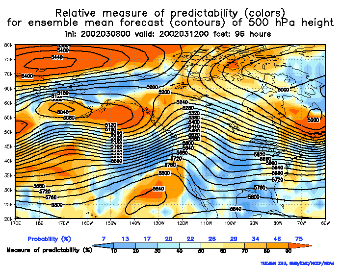
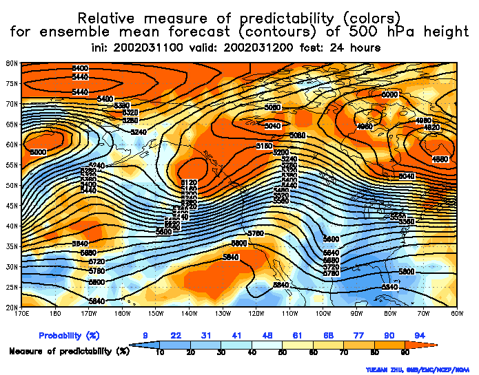
the Relative Measure of Predictability (RMOP)
charts at 96- and 24-hour
lead time also reveal a striking difference in terms of the predictability
of the upper level waves associated with the two precipitation events.
The wave in the NW/SE is associated with a high/low level of predictability.
Even at 1-day lead time, probabilistic geopotential height forecasts around
the low pressure wave in the SE do not reach the 50% value, while even
at 4-day lead time they remain as high as 75% in the area of the NW wave,
indicating that the latter system had a much higher level of predictability.
Return to ensemble training page